KARAMÜRSEL Village Digital Map | Updated Neighbourhood Map
Çankırı ilinde,
Kızılırmak ilçesinde, köyler içinde,
Mesken sayısı bakımından öne çıkan listesinde 5. Karamürsel listede 5. sırada yer alır.
Ticarî yoğunluk açısından önde listesinde 3. Karamürsel listede üçüncü sırada olmasıyla bilinir.
Eğitim göstergeleri düşük seyrede listesinde 2. Karamürsel listede ikinci basamakta yer alır.
Sokak ağı güçlü olan listesinde 4. Karamürsel sıralamada dördüncü sıradadır.
| Adi | KARAMÜRSEL Province Affiliated | ÇANKIRI District Affiliated | KIZILIRMAK Postal code | 18282 Number of Streets | 1 Population Density km2-people | 8.69 Number of Apartments with business Licenses | 2 Number of Apartments with Residential Licenses | 154 Number of Households / Families | 94 Total Population | 214 Male Population | 105 Woman Population | 109 Income Per Person - Spendable TL-Month | 4.968 |
|---|
KARAMÜRSEL Village Map | Detailed Villages and Neighbourhoods
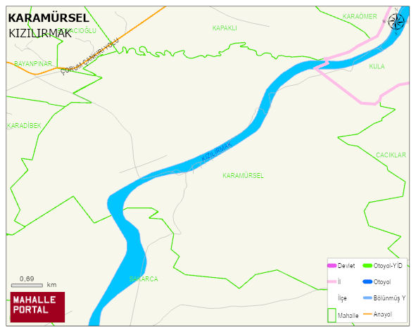
KARAMÜRSEL Village Digital Map | Updated Neighbourhood Map
KARAMÜRSEL Village – Population, Postal Code, Number of Workplaces
KARAMÜRSEL village KIZILIRMAK district of ÇANKIRI province. UAVT (National Address Database Code) Village Code: 8859. Postal Code: 18282. KARAMÜRSEL 1 streets and avenues, 2 independent business licensed apartments, 143 residential licensed apartments, 98 households. 231 people live in this settlement. 118 male, 113 female.
Leave a Comment