KARAPINAR Village Digital Map | Interactive Neighbourhoods
Zonguldak ilinde,
Gökçebey ilçesinde, köyler içinde,
Ekonomik faaliyetlerin merkezi listesinde 3. Karapınar sıralamada üçüncü sırada yer almaktadır.
Lüks yaşam oranı en yüksek listesinde 5. Karapınar istatistik listelerinde beşinci basamakta yer alır.
Bekar hane oranı yüksek listesinde 4. Karapınar dördüncü sırada bulunmasıyla dikkat çeker.
| Adi | KARAPINAR Province Affiliated | ZONGULDAK District Affiliated | GÖKÇEBEY Postal code | 67672 Number of Streets | 3 Population Density km2-people | 195.88 Number of Apartments with business Licenses | 29 Number of Apartments with Residential Licenses | 281 Number of Households / Families | 159 Total Population | 450 Male Population | 227 Woman Population | 223 Income Per Person - Spendable TL-Month | 5.904 |
|---|
KARAPINAR Village Map | Terrain and Topography
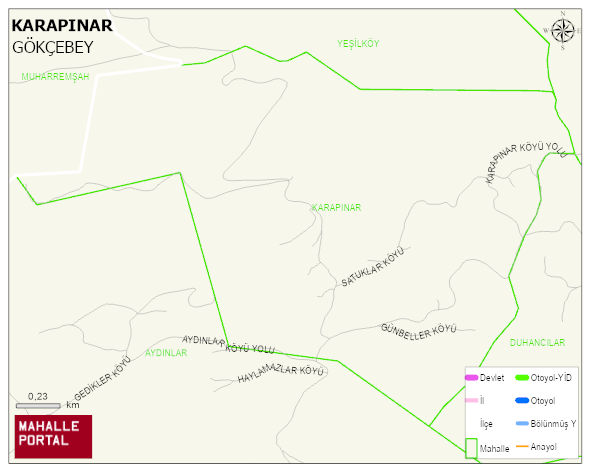
KARAPINAR Village Digital Map | Interactive Neighbourhoods
KARAPINAR Village – Population, Postal Code, Number of Workplaces
KARAPINAR village GÖKÇEBEY district of ZONGULDAK province. UAVT (National Address Database Code) Village Code: 34707. Postal Code: 67672. KARAPINAR 3 streets and avenues, 29 independent business licensed apartments, 280 residential licensed apartments, 156 households. 452 people live in this settlement. 230 male, 222 female. 96 people have never married, 249 people are married, 16 people are divorced and 40 people have passed away. The number of people aged 60 and over is 126. The population rate of 60+ people is % 27
Leave a Comment