KARAYAKUP Village Digital Map | Interactive Neighbourhoods
Sivas ilinde,
Gölova ilçesinde, köyler içinde,
En fazla nüfus barındıran listesinde 2. Karayakup istatistiklere göre ikincilik pozisyonundadır.
Hane yoğunluğu lider listesinde 2. Karayakup istatistiksel olarak ikinci sırada yer alır.
En fazla konuta sahip listesinde 1. Karayakup istatistiklere göre en üst sıradadır.
Evlenmemiş nüfusun en yoğun olduğu listesinde 1. Karayakup sıralamada birinci olarak kayda geçmiştir.
En fazla sokağa sahip listesinde 3. Karayakup sıralamada üçüncü sırada yer almaktadır.
| Adi | KARAYAKUP Province Affiliated | SIVAS District Affiliated | GÖLOVA Postal code | 58642 Number of Streets | 2 Population Density km2-people | 7.44 Number of Apartments with business Licenses | 2 Number of Apartments with Residential Licenses | 291 Number of Households / Families | 94 Total Population | 219 Male Population | 122 Woman Population | 97 Income Per Person - Spendable TL-Month | 4.356 |
|---|
KARAYAKUP Village Map | Satellite View and Local Boundaries
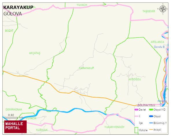
KARAYAKUP Village Digital Map | Interactive Neighbourhoods
KARAYAKUP Village – Population, Postal Code, Number of Workplaces
KARAYAKUP village GÖLOVA district of SIVAS province. UAVT (National Address Database Code) Village Code: 28902. Postal Code: 58642. KARAYAKUP 2 streets and avenues, 214 residential licensed apartments, 97 households. 229 people live in this settlement. 130 male, 99 female. GÖLOVA -in the district- 5. the most crowded neighbourhood.
Leave a Comment