TOP 10: NÜFUS
Şanlıurfa ilinde,
Karaköprü ilçesinde, mahalleler içinde,
En varlıklı nüfusun yaşadığı listesinde 3. Karşıyaka istatistiklere göre üçüncülük pozisyonundadır.
Üniversite mezunlarının en yoğun olduğu listesinde 5. Karşıyaka sıralamada beşinci sırada yer almaktadır.
Gayrimenkul rayici en yüksek listesinde 2. Karşıyaka ikinci sırada yer almaktadır.
Refah seviyesi yüksek nüfus yoğunluğu listesinde 4. Karşıyaka 4. sırada kayıtlı, bölgenin önde gelen yerleşimlerinden biridir.
| Adi | KARSIYAKA Province Affiliated | SANLIURFA District Affiliated | KARAKÖPRÜ Postal code | 63320 Number of Streets | 41 Population Density km2-people | 16327.50 Number of Apartments with business Licenses | 257 Number of Apartments with Residential Licenses | 4153 Number of Households / Families | 2883 Total Population | 11311 Male Population | 5513 Woman Population | 5798 Income Per Person - Spendable TL-Month | 20.547 |
|---|
KARSIYAKA Neighbourhood Map | Geography and Natural Features
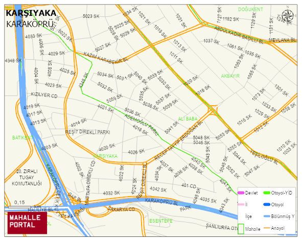
KARSIYAKA Neighbourhood Digital Map | Terrain and Topography
KARSIYAKA Neighbourhood – Population, Postal Code, Number of Workplaces
KARSIYAKA neighborhood is located in KARAKÖPRÜ district of SANLIURFA province. UAVT (National Address Database Code) Neighborhood Code: 80315. Postal Code: 63320. The population density is -per square kilometer- 16014 people. KARSIYAKA 42 streets and avenues, 251 independent business licensed apartments, 3972 residential licensed apartments, 2859 households. 11098 people live in this settlement. 5440 male, 5658 female. 2661 people have never married, 4715 people are married, 176 people are divorced and 239 people have passed away. The number of people aged 60 and over is 880. The population rate of 60+ people is % 7 and the ratio of children under the age of 10 to the population is % 18 KARAKÖPRÜ -in the district- 9. the most crowded neighbourhood.