KAS Village Digital Map | Updated Neighbourhood Map
Gümüşhane ilinde, köyler içinde,
Kentsel sokak yoğunluğu yüksek listesinde 3. Kaş üst sıralarda yer aldı.
Kelkit ilçesinde, köyler içinde,
Nüfus açısından zirvede yer alan listesinde 4. Kaş istatistiksel olarak 4. sıradadır.
Aile yaşamının en yoğun olduğu listesinde 4. Kaş istatistik listelerinde 4. sıradadır.
Konut kapasitesi en geniş listesinde 4. Kaş sıralamada dördüncü sıradadır.
Dükkan ve işyeri bakımından ilk sırada listesinde 2. Kaş 2. sırada, bölgenin önde gelen yerleşimlerinden biridir.
Toprak birim fiyatı en yüksek listesinde 1. Kaş sıralamada en üstte yer almaktadır.
Kentsel sokak yoğunluğu yüksek listesinde 1. Kaş istatistiklere göre en üst sıradadır.
| Adi | KAS Province Affiliated | GÜMÜSHANE District Affiliated | KELKIT Postal code | 29602 Number of Streets | 43 Population Density km2-people | 11.46 Number of Apartments with business Licenses | 11 Number of Apartments with Residential Licenses | 373 Number of Households / Families | 111 Total Population | 240 Male Population | 137 Woman Population | 103 Income Per Person - Spendable TL-Month | 7.253 |
|---|
KAS Village Map | All Neighbourhoods and Settlements
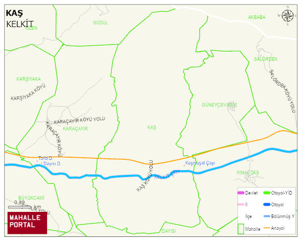
KAS Village Digital Map | Updated Neighbourhood Map
KAS Village – Population, Postal Code, Number of Workplaces
KAS village KELKIT district of GÜMÜSHANE province. UAVT (National Address Database Code) Village Code: 15046. Postal Code: 29602. KAS 43 streets and avenues, 11 independent business licensed apartments, 367 residential licensed apartments, 126 households. 290 people live in this settlement. 166 male, 124 female. 60 and over is 110. The population rate of 60+ people is % 37
Leave a Comment