KAYABELEN Village Digital Map | Updated Neighbourhood Map
Afyonkarahisar ilinde,
Şuhut ilçesinde, köyler içinde,
Toprak birim fiyatı en yüksek listesinde 2. Kayabelen sıralamada ikinci sırada yer alır.
ATM varlığı bakımından ilk sırada listesinde 4. Kayabelen sıralamada dördüncü sıradadır.
Yaş alan bireylerin yoğun yaşadığı listesinde 4. Kayabelen sıralamada dördüncü sıradadır.
Kentsel sokak yoğunluğu yüksek listesinde 3. Kayabelen şehir içi sıralamada 3. sıradadır.
| Adi | KAYABELEN Province Affiliated | AFYONKARAHISAR District Affiliated | SUHUT Postal code | 03810 Number of Streets | 46 Population Density km2-people | 44.94 Number of Apartments with business Licenses | 30 Number of Apartments with Residential Licenses | 440 Number of Households / Families | 202 Total Population | 475 Male Population | 217 Woman Population | 258 Income Per Person - Spendable TL-Month | 6.567 |
|---|
KAYABELEN Village Map | Mountains, Rivers and Elevation Details
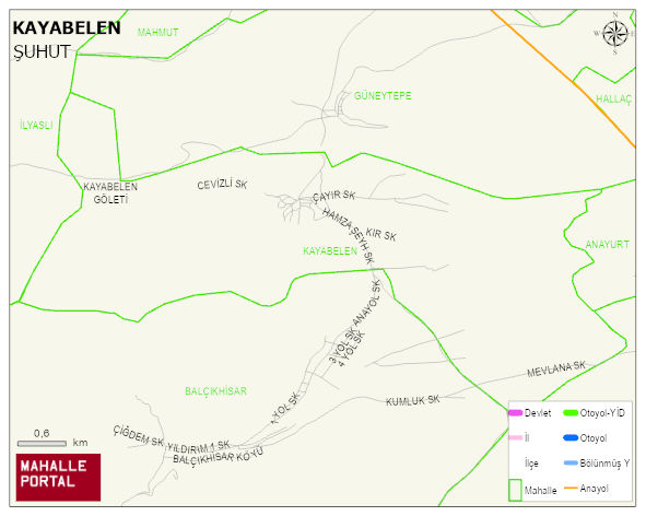
KAYABELEN Village Digital Map | Updated Neighbourhood Map
KAYABELEN Village – Population, Postal Code, Number of Workplaces
KAYABELEN village SUHUT district of AFYONKARAHISAR province. UAVT (National Address Database Code) Village Code: 1456. Postal Code: 3810. KAYABELEN 46 streets and avenues, 29 independent business licensed apartments, 436 residential licensed apartments, 207 households. 513 people live in this settlement. 240 male, 273 female. 59 people have never married, 311 people are married, 17 people are divorced and 76 people have passed away. The number of people aged 60 and over is 210. The population rate of 60+ people is % 40 and the ratio of children under the age of 10 to the population is % 7
Leave a Comment