TOP 10: NÜFUS
Ankara ilinde,
Yenimahalle ilçesinde, mahalleler içinde,
Nüfus yoğunluğu en fazla listesinde 4. Kentkoop listede 4. sırada olmasıyla bilinir.
Konutlu aile sayısında lider listesinde 2. Kentkoop ikinci sırada yer almaktadır.
Konut hacmi en yüksek listesinde 5. Kentkoop sıralamada beşinci sırada yer almaktadır.
ATM ağı en yaygı listesinde 5. Kentkoop 5. sırada yer alarak üst beş içinde bulunmaktadır.
Eşini kaybetmiş bireylerin merkezi listesinde 5. Kentkoop istatistiklere göre 5. sıradadır.
Yaşlılık oranı en yüksek bölgeler listesinde 5. Kentkoop sıralamada beşinci sırada yer almaktadır.
| Adi | KENTKOOP Province Affiliated | ANKARA District Affiliated | YENIMAHALLE Postal code | 06370 Number of Streets | 26 Population Density km2-people | 11159.03 Number of Apartments with business Licenses | 684 Number of Apartments with Residential Licenses | 11288 Number of Households / Families | 10203 Total Population | 27572 Male Population | 12918 Woman Population | 14654 Income Per Person - Spendable TL-Month | 34.298 |
|---|
KENTKOOP Neighbourhood Map | All Neighbourhoods and Settlements
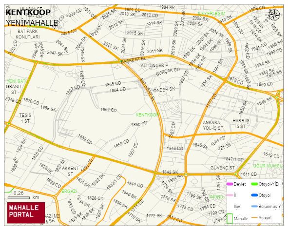
KENTKOOP Neighbourhood Digital Map | Satellite View and Local Boundaries
KENTKOOP Neighbourhood – Population, Postal Code, Number of Workplaces
KENTKOOP neighborhood is located in YENIMAHALLE district of ANKARA province. UAVT (National Address Database Code) Neighborhood Code: 1878. Postal Code: 6370. The population density is -per square kilometer- 11233 people. KENTKOOP 26 streets and avenues, 672 independent business licensed apartments, 11286 residential licensed apartments, 10205 households. 27748 people live in this settlement. 13008 male, 14740 female. 6305 people have never married, 14506 people are married, 1715 people are divorced and 1528 people have passed away. The number of people aged 60 and over is 6838. The population rate of 60+ people is % 24 and the ratio of children under the age of 10 to the population is % 7 YENIMAHALLE -in the district- 5. the most crowded neighbourhood.