KETENÇUKUR Village Digital Map | Mountains, Rivers and Elevation Details
Giresun ilinde,
Tirebolu ilçesinde, köyler içinde,
Mahalle içi yol/sokak sayısı zirvede listesinde 5. Ketençukur sıralamada beşinci sırada yer almaktadır.
Tirebolu ilçesinde, köyler içinde,
Mahalle içi yol/sokak sayısı zirvede listesinde 5. Ketençukur sıralamada beşinci sırada yer almaktadır.
| Adi | KETENÇUKUR Province Affiliated | GIRESUN District Affiliated | TIREBOLU Postal code | 28502 Number of Streets | 10 Population Density km2-people | 31.72 Number of Apartments with business Licenses | 10 Number of Apartments with Residential Licenses | 523 Number of Households / Families | 147 Total Population | 277 Male Population | 147 Woman Population | 130 Income Per Person - Spendable TL-Month | 5.635 |
|---|
KETENÇUKUR Village Map | Updated Neighbourhood Map
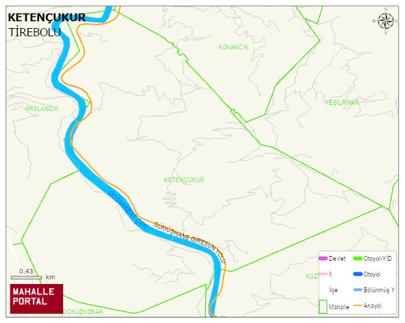
KETENÇUKUR Village Digital Map | Mountains, Rivers and Elevation Details
KETENÇUKUR Village – Population, Postal Code, Number of Workplaces
KETENÇUKUR village TIREBOLU district of GIRESUN province. UAVT (National Address Database Code) Village Code: 14848. Postal Code: 28502. KETENÇUKUR 10 streets and avenues, 9 independent business licensed apartments, 520 residential licensed apartments, 154 households. 300 people live in this settlement. 160 male, 140 female. 60 and over is 150. The population rate of 60+ people is % 50
Leave a Comment