TOP 10: NÜFUS
Aksaray ilinde, mahalleler içinde,
Eşini kaybetmiş bireylerin merkezi listesinde 4. Kızılırmak grafikte üst sıralarda yer aldı.
Yaşlılık oranı en yüksek bölgeler listesinde 4. Kızılırmak üst sıralarda dikkat çekti.
Sarıyahşi ilçesinde, mahalleler içinde,
Öğretim düzeyi gelişmeye açık listesinde 1. Kızılırmak kayıtlarda birinci sırada gözükmektedir.
Eşini kaybetmiş bireylerin merkezi listesinde 1. Kızılırmak yer alır.
Yaşlılık oranı en yüksek bölgeler listesinde 2. Kızılırmak yer alır.
| Adi | KIZILIRMAK Province Affiliated | AKSARAY District Affiliated | SARIYAHSI Postal code | 68700 Number of Streets | 12 Population Density km2-people | 77.56 Number of Apartments with business Licenses | 3 Number of Apartments with Residential Licenses | 138 Number of Households / Families | 81 Total Population | 275 Male Population | 128 Woman Population | 147 Income Per Person - Spendable TL-Month | 11.278 |
|---|
KIZILIRMAK Neighbourhood Map | Detailed Villages and Neighbourhoods
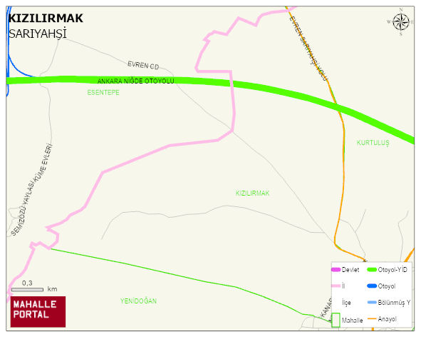
KIZILIRMAK Neighbourhood Digital Map | Boundaries of Villages
KIZILIRMAK Neighbourhood – Population, Postal Code, Number of Workplaces
KIZILIRMAK neighborhood is located in SARIYAHSI district of AKSARAY province. UAVT (National Address Database Code) Neighborhood Code: 90118. Postal Code: 68700. The population density is -per square kilometer- 88 people. KIZILIRMAK 12 streets and avenues, 3 independent business licensed apartments, 136 residential licensed apartments, 81 households. 313 people live in this settlement. 148 male, 165 female. 68 people have never married, 181 people are married, 18 people are divorced and 18 people have passed away. The number of people aged 60 and over is 81. The population rate of 60+ people is % 25 SARIYAHSI -in the district- 8. the most crowded neighbourhood.