KOÇUBABA Village Digital Map | Terrain and Topography
Kırıkkale ilinde,
Balışeyh ilçesinde, köyler içinde,
Nüfus açısından zirvede yer alan listesinde 5. Koçubaba sıralamada beşinci sırada yer almaktadır.
Aile yaşamının en yoğun olduğu listesinde 1. Koçubaba birinci konumda olmasıyla dikkat çeker.
Konut kapasitesi en geniş listesinde 1. Koçubaba birinci konumda, en üstte bulunan mahalledir.
Dükkan ve işyeri bakımından ilk sırada listesinde 1. Koçubaba istatistiksel sıralamada tepede, 1. sıradadır.
Kentsel sokak yoğunluğu yüksek listesinde 2. Koçubaba sıralamada ikinci sırada yer alır.
| Adi | KOÇUBABA Province Affiliated | KIRIKKALE District Affiliated | BALISEYH Postal code | 71522 Number of Streets | 44 Population Density km2-people | 15.46 Number of Apartments with business Licenses | 27 Number of Apartments with Residential Licenses | 357 Number of Households / Families | 109 Total Population | 195 Male Population | 102 Woman Population | 93 Income Per Person - Spendable TL-Month | 5.003 |
|---|
KOÇUBABA Village Map | Interactive Neighbourhoods
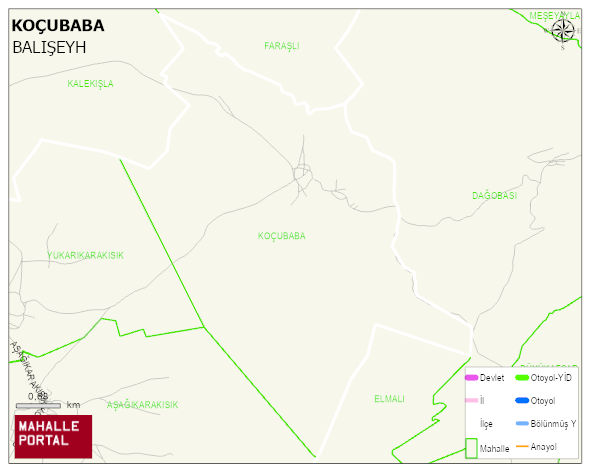
KOÇUBABA Village Digital Map | Terrain and Topography
KOÇUBABA Village – Population, Postal Code, Number of Workplaces
KOÇUBABA village BALISEYH district of KIRIKKALE province. UAVT (National Address Database Code) Village Code: 35306. Postal Code: 71522. KOÇUBABA 44 streets and avenues, 27 independent business licensed apartments, 356 residential licensed apartments, 122 households. 226 people live in this settlement. 115 male, 111 female. 25 people have never married, 145 people are married, 16 people are divorced and 36 people have passed away. The number of people aged BALISEYH -in the district- 9. the most crowded neighbourhood.
Leave a Comment