KOÇYATAGI Village Digital Map | All Neighbourhoods and Settlements
Afyonkarahisar ilinde,
Şuhut ilçesinde, köyler içinde,
ATM ağı en yaygı listesinde 5. Koçyatağı listede beşinci sırada yer almaktadır.
Yaşlılık oranı en yüksek bölgeler listesinde 1. Koçyatağı birinci konumda, en üstte bulunan mahalledir.
Şuhut ilçesinde, köyler içinde,
ATM ağı en yaygı listesinde 5. Koçyatağı listede beşinci sırada yer almaktadır.
Yaşlılık oranı en yüksek bölgeler listesinde 1. Koçyatağı birinci konumda, en üstte bulunan mahalledir.
| Adi | KOÇYATAGI Province Affiliated | AFYONKARAHISAR District Affiliated | SUHUT Postal code | 03810 Number of Streets | 14 Population Density km2-people | 4.53 Number of Apartments with business Licenses | 11 Number of Apartments with Residential Licenses | 269 Number of Households / Families | 126 Total Population | 276 Male Population | 137 Woman Population | 139 Income Per Person - Spendable TL-Month | 5.457 |
|---|
KOÇYATAGI Village Map | Interactive Neighbourhoods
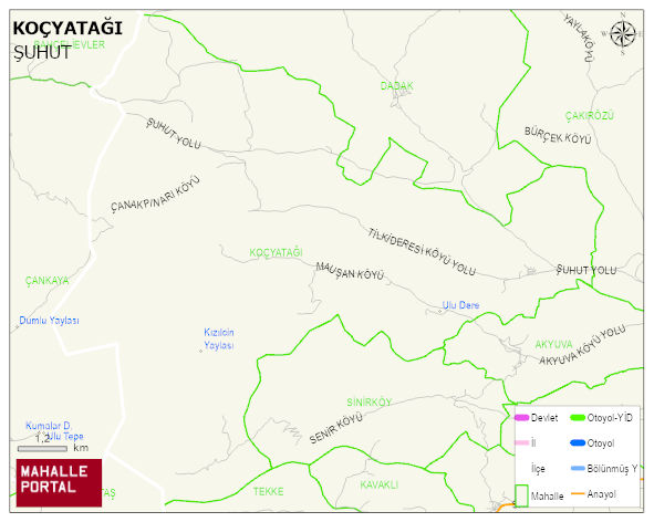
KOÇYATAGI Village Digital Map | All Neighbourhoods and Settlements
KOÇYATAGI Village – Population, Postal Code, Number of Workplaces
KOÇYATAGI village SUHUT district of AFYONKARAHISAR province. UAVT (National Address Database Code) Village Code: 1458. Postal Code: 3810. KOÇYATAGI 14 streets and avenues, 11 independent business licensed apartments, 268 residential licensed apartments, 124 households. 278 people live in this settlement. 136 male, 142 female. 32 people have never married, 171 people are married, 15 people are divorced and 40 people have passed away. The number of people aged 60 and over is 136. The population rate of 60+ people is % 48
Leave a Comment