KORUCAK Village Digital Map | Geography and Natural Features
Zonguldak ilinde,
Merkez ilçesinde, köyler içinde,
Evlenmemiş nüfusun en yoğun olduğu listesinde 3. Korucak sıralamada üçüncü sırada yer almaktadır.
65+ nüfusu en yoğun olan listesinde 4. Korucak istatistiklere göre dördüncü basamakta yer alır.
En fazla sokağa sahip listesinde 4. Korucak 4. sırada kayıtlı, bölgenin önde gelen yerleşimlerinden biridir.
| Adi | KORUCAK Province Affiliated | ZONGULDAK District Affiliated | MERKEZ Postal code | 67980 Number of Streets | 7 Population Density km2-people | 68.57 Number of Apartments with business Licenses | 2 Number of Apartments with Residential Licenses | 395 Number of Households / Families | 195 Total Population | 477 Male Population | 245 Woman Population | 232 Income Per Person - Spendable TL-Month | 6.755 |
|---|
KORUCAK Village Map | Boundaries of Villages
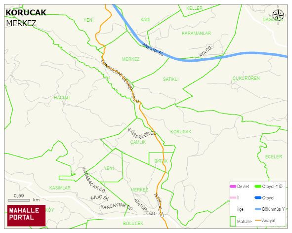
KORUCAK Village Digital Map | Geography and Natural Features
KORUCAK Village – Population, Postal Code, Number of Workplaces
KORUCAK village MERKEZ district of ZONGULDAK province. UAVT (National Address Database Code) Village Code: 34332. Postal Code: 67980. KORUCAK 7 streets and avenues, 2 independent business licensed apartments, 393 residential licensed apartments, 193 households. 489 people live in this settlement. 252 male, 237 female. 105 people have never married, 278 people are married, 15 people are divorced and 58 people have passed away. The number of people aged 60 and over is 163. The population rate of 60+ people is % 33
Leave a Comment