KORUPINAR Village Digital Map | Updated Neighbourhood Map
Kastamonu ilinde, köyler içinde,
Doğurganlık etkisi yüksek listesinde 4. Korupınar üst sıralarda dikkat çekti.
İnebolu ilçesinde, köyler içinde,
Nüfus yoğunluğu en fazla listesinde 1. Korupınar en üst sırada bulunan yerleşimlerden biridir.
Konutlu aile sayısında lider listesinde 1. Korupınar bölge sıralamasında birinci sıradadır.
Konut hacmi en yüksek listesinde 3. Korupınar istatistiksel olarak üçüncü sıradadır.
Doğurganlık etkisi yüksek listesinde 3. Korupınar sıralamada üçüncü sırada yer almaktadır.
| Adi | KORUPINAR Province Affiliated | KASTAMONU District Affiliated | INEBOLU Postal code | 37502 Number of Streets | 4 Population Density km2-people | 135.37 Number of Apartments with business Licenses | 3 Number of Apartments with Residential Licenses | 236 Number of Households / Families | 149 Total Population | 527 Male Population | 270 Woman Population | 257 Income Per Person - Spendable TL-Month | 5.711 |
|---|
KORUPINAR Village Map | Terrain and Topography
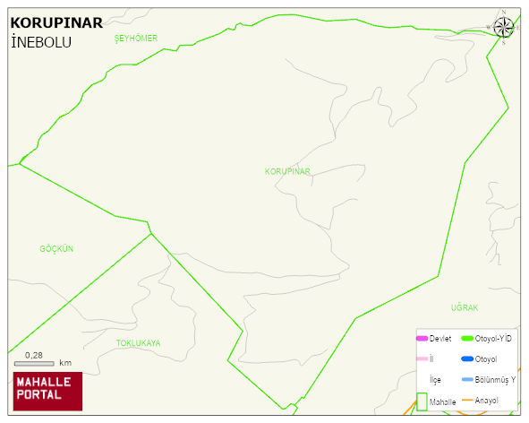
KORUPINAR Village Digital Map | Updated Neighbourhood Map
KORUPINAR Village – Population, Postal Code, Number of Workplaces
KORUPINAR village INEBOLU district of KASTAMONU province. UAVT (National Address Database Code) Village Code: 18688. Postal Code: 37502. KORUPINAR 4 streets and avenues, 3 independent business licensed apartments, 234 residential licensed apartments, 147 households. 528 people live in this settlement. 268 male, 260 female. 60 and over is 93. The population rate of 60+ people is % 17 and the ratio of children under the age of 10 to the population is % 15 INEBOLU -in the district- 6. the most crowded neighbourhood.
Leave a Comment