KOZLUBAG Village Digital Map | Updated Neighbourhood Map
Kilis ilinde, köyler içinde,
Eğitim göstergeleri düşük seyrede listesinde 5. Kozlubağ zirveye en yakın grupta yer alıyor.
Musabeyli ilçesinde, köyler içinde,
Eğitim göstergeleri düşük seyrede listesinde 2. Kozlubağ sıralamada ikinci sırada yer almaktadır.
Bekârlık oranı bakımından ilk sırada listesinde 4. Kozlubağ sıralamada dördüncü konumdadır.
| Adi | KOZLUBAG Province Affiliated | KILIS District Affiliated | MUSABEYLI Postal code | 79602 Number of Streets | 1 Population Density km2-people | 18.04 Number of Apartments with business Licenses | 0 Number of Apartments with Residential Licenses | 93 Number of Households / Families | 40 Total Population | 145 Male Population | 78 Woman Population | 67 Income Per Person - Spendable TL-Month | 5.268 |
|---|
KOZLUBAG Village Map | Detailed Villages and Neighbourhoods
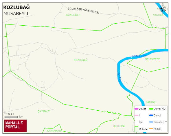
KOZLUBAG Village Digital Map | Updated Neighbourhood Map
KOZLUBAG Village – Population, Postal Code, Number of Workplaces
KOZLUBAG village MUSABEYLI district of KILIS province. UAVT (National Address Database Code) Village Code: 37119. Postal Code: 79602. KOZLUBAG 1 streets and avenues, 92 residential licensed apartments, 43 households. 168 people live in this settlement. 87 male, 81 female.
Leave a Comment