KOZLUBUCAK Village Digital Map | Terrain and Topography
Karaman ilinde,
Merkez ilçesinde, köyler içinde,
A+ ve A gelir grubunun en yoğun olduğu listesinde 5. Kozlubucak istatistiklere göre 5. sıradadır.
Merkez ilçesinde, köyler içinde,
A+ ve A gelir grubunun en yoğun olduğu listesinde 5. Kozlubucak istatistiklere göre 5. sıradadır.
| Adi | KOZLUBUCAK Province Affiliated | KARAMAN District Affiliated | MERKEZ Postal code | 70202 Number of Streets | 2 Population Density km2-people | 9.93 Number of Apartments with business Licenses | 10 Number of Apartments with Residential Licenses | 79 Number of Households / Families | 37 Total Population | 102 Male Population | 57 Woman Population | 45 Income Per Person - Spendable TL-Month | 5.604 |
|---|
KOZLUBUCAK Village Map | All Neighbourhoods and Settlements
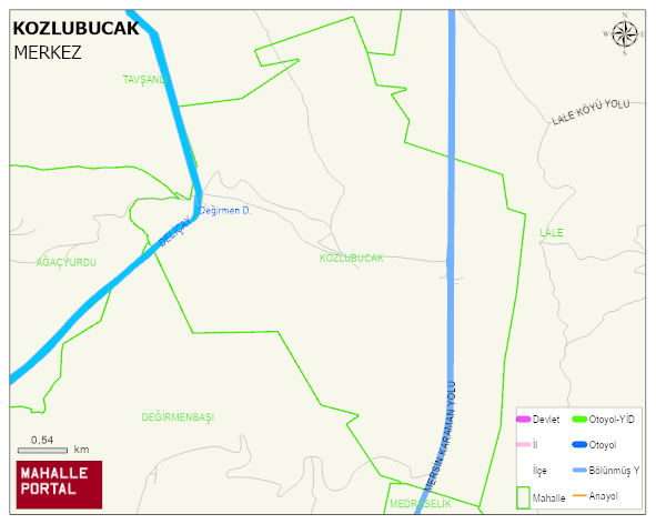
KOZLUBUCAK Village Digital Map | Terrain and Topography
KOZLUBUCAK Village – Population, Postal Code, Number of Workplaces
KOZLUBUCAK village MERKEZ district of KARAMAN province. UAVT (National Address Database Code) Village Code: 35122. Postal Code: 70202. KOZLUBUCAK 2 streets and avenues, 10 independent business licensed apartments, 79 residential licensed apartments, 32 households. 91 people live in this settlement. 50 male, 41 female.
Leave a Comment