KUMLUCA Village Digital Map | Interactive Neighbourhoods
Ağrı ilinde,
Taşlıçay ilçesinde, köyler içinde,
En yoğun nüfuslu listesinde 1. Kumluca istatistiklere göre listenin başında bulunur.
Ekonomik gücü en yüksek listesinde 4. Kumluca sıralamada dördüncülük pozisyonundadır.
Ev–hane sayısı en çok olan listesinde 1. Kumluca birinci sırada yer alan önemli bir mahallesi vardır.
Ev sayısı bakımından ilk sırada listesinde 1. Kumluca 1. sırada yer alan, öne çıkan mahalledir.
Esnaf–işletme sayısı lider listesinde 1. Kumluca sıralamada birinci olarak kayda geçmiştir.
| Adi | KUMLUCA Province Affiliated | AGRI District Affiliated | TASLIÇAY Postal code | 04802 Number of Streets | 2 Population Density km2-people | 54.00 Number of Apartments with business Licenses | 26 Number of Apartments with Residential Licenses | 365 Number of Households / Families | 311 Total Population | 1523 Male Population | 787 Woman Population | 736 Income Per Person - Spendable TL-Month | 3.877 |
|---|
KUMLUCA Village Map | Satellite View and Local Boundaries
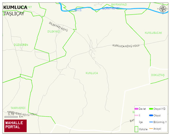
KUMLUCA Village Digital Map | Interactive Neighbourhoods
KUMLUCA Village – Population, Postal Code, Number of Workplaces
KUMLUCA village TASLIÇAY district of AGRI province. UAVT (National Address Database Code) Village Code: 1954. Postal Code: 4802. KUMLUCA 2 streets and avenues, 27 independent business licensed apartments, 355 residential licensed apartments, 309 households. 1524 people live in this settlement. 783 male, 741 female. 60 and over is 112. The population rate of 60+ people is % 7 and the ratio of children under the age of 10 to the population is % 24 TASLIÇAY -in the district- 3. the most crowded neighbourhood.
Leave a Comment