KUNDUZLU Village Digital Map | Interactive Neighbourhoods
Çorum ilinde,
Bayat ilçesinde, köyler içinde,
Maddi refahı zirvede olan listesinde 2. Kunduzlu sıralamada 2. basamakta gözükür.
Hane yoğunluğu lider listesinde 3. Kunduzlu 3. sırada konumlanan önemli bir yerleşimdir.
En fazla konuta sahip listesinde 2. Kunduzlu sıralamada ikinci sırada yer almaktadır.
Rayiç bedeli zirvede listesinde 4. Kunduzlu 4. sırada konumlanmış, öne çıkan bir yerleşimdir.
65+ nüfusu en yoğun olan listesinde 2. Kunduzlu ikinci konumda bulunan mahalledir.
En fazla sokağa sahip listesinde 4. Kunduzlu istatistik listelerinde 4. sıradadır.
| Adi | KUNDUZLU Province Affiliated | ÇORUM District Affiliated | BAYAT Postal code | 19802 Number of Streets | 5 Population Density km2-people | 8.28 Number of Apartments with business Licenses | 8 Number of Apartments with Residential Licenses | 463 Number of Households / Families | 182 Total Population | 408 Male Population | 184 Woman Population | 224 Income Per Person - Spendable TL-Month | 9.046 |
|---|
KUNDUZLU Village Map | Updated Neighbourhood Map
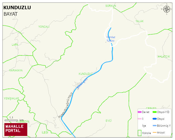
KUNDUZLU Village Digital Map | Interactive Neighbourhoods
KUNDUZLU Village – Population, Postal Code, Number of Workplaces
KUNDUZLU village BAYAT district of ÇORUM province. UAVT (National Address Database Code) Village Code: 9332. Postal Code: 19802. KUNDUZLU 5 streets and avenues, 8 independent business licensed apartments, 463 residential licensed apartments, 191 households. 444 people live in this settlement. 201 male, 243 female. 60 and over is 220. The population rate of 60+ people is % 49 BAYAT -in the district- 9. the most crowded neighbourhood.
Leave a Comment