| Adi | KURSUNLUK Province Affiliated | USAK District Affiliated | MERKEZ Postal code | 64050 Number of Streets | 114 Population Density km2-people | 339.04 Number of Apartments with business Licenses | 107 Number of Apartments with Residential Licenses | 1847 Number of Households / Families | 892 Total Population | 2571 Male Population | 1271 Woman Population | 1300 Income Per Person - Spendable TL-Month | 17.164 |
|---|
KURSUNLUK Neighbourhood Map | Satellite View and Local Boundaries
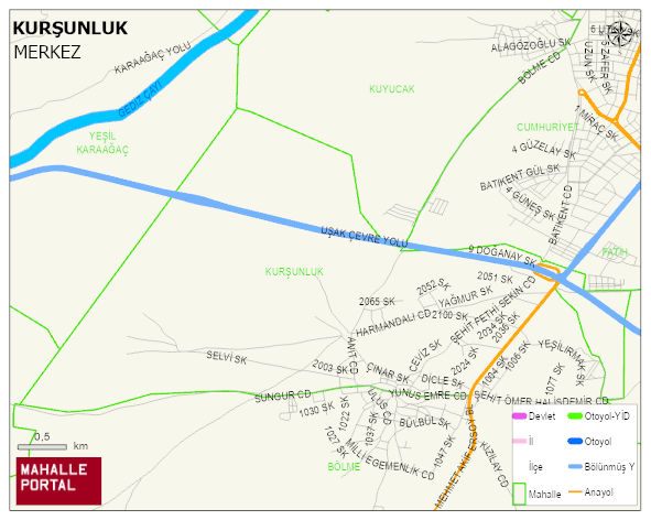
KURSUNLUK Neighbourhood Digital Map | Mountains, Rivers and Elevation Details
KURSUNLUK Neighbourhood – Population, Postal Code, Number of Workplaces
KURSUNLUK neighborhood is located in MERKEZ district of USAK province. UAVT (National Address Database Code) Neighborhood Code: 80479. Postal Code: 64050. The population density is -per square kilometer- 327 people. KURSUNLUK 113 streets and avenues, 103 independent business licensed apartments, 1840 residential licensed apartments, 865 households. 2482 people live in this settlement. 1235 male, 1247 female. 341 people have never married, 1417 people are married, 85 people are divorced and 94 people have passed away. The number of people aged 60 and over is 393. The population rate of 60+ people is % 15 and the ratio of children under the age of 10 to the population is % 15
Leave a Comment