TOP 10: NÜFUS
Giresun ilinde,
Çamoluk ilçesinde, mahalleler içinde,
En çok kazanç sağlaya listesinde 3. Kurukol sıralamada üçüncü sırada yer almaktadır.
En çok yerleşim birimi barındıran listesinde 5. Kurukol beşinci sırada konumlanan mahallelerden biridir.
Eğitim seviyesinde alt sıralarda listesinde 3. Kurukol 3. sırada kayıtlı olan önemli bir yerleşimdir.
Bekar hane oranı yüksek listesinde 4. Kurukol yer alır.
| Adi | KURUKOL Province Affiliated | GIRESUN District Affiliated | ÇAMOLUK Postal code | 28712 Number of Streets | 1 Population Density km2-people | 12.00 Number of Apartments with business Licenses | 4 Number of Apartments with Residential Licenses | 254 Number of Households / Families | 0 Total Population | 202 Male Population | 122 Woman Population | 80 Income Per Person - Spendable TL-Month | 10.585 |
|---|
KURUKOL Neighbourhood Map | Terrain and Topography
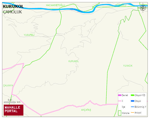
KURUKOL Neighbourhood Digital Map | Detailed Villages and Neighbourhoods
KURUKOL Neighbourhood – Population, Postal Code, Number of Workplaces
KURUKOL ÇAMOLUK district of GIRESUN iline baglidir. UAVT (Ulusal Adres Veritabani Kodu) Kodu: 30767. Postal Code: 28712. 254 adet konut ruhsatli daire ve 4 adet isyeri ruhsatli bagimsiz birim barindirir. Bu yerlesimde 248 people live in this settlement. 144 male, 104 female. ÇAMOLUK -in the district- 9. the most crowded neighbourhood.
Leave a Comment