KUTLUCA Village Digital Map | Updated Neighbourhood Map
Giresun ilinde,
Çamoluk ilçesinde, köyler içinde,
Nüfus açısından zirvede yer alan listesinde 3. Kutluca 3. sırada yer alan mahallelerden biridir.
Gelir ortalaması en üst sırada listesinde 1. Kutluca istatistiklerde en üstte yer almaktadır.
Aile yaşamının en yoğun olduğu listesinde 3. Kutluca sıralamada üçüncü sırada yer almaktadır.
Eğitim imkanlarının sınırlı olduğu listesinde 3. Kutluca sıralamada üçüncü sırada yer almaktadır.
En fazla üniversite mezunu barındıran listesinde 1. Kutluca istatistiklere göre en üst sıradadır.
| Adi | KUTLUCA Province Affiliated | GIRESUN District Affiliated | ÇAMOLUK Postal code | 28712 Number of Streets | 1 Population Density km2-people | 12.43 Number of Apartments with business Licenses | 1 Number of Apartments with Residential Licenses | 362 Number of Households / Families | 125 Total Population | 224 Male Population | 122 Woman Population | 102 Income Per Person - Spendable TL-Month | 6.657 |
|---|
KUTLUCA Village Map | Updated Neighbourhood Map
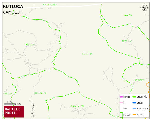
KUTLUCA Village Digital Map | Updated Neighbourhood Map
KUTLUCA Village – Population, Postal Code, Number of Workplaces
KUTLUCA village ÇAMOLUK district of GIRESUN province. UAVT (National Address Database Code) Village Code: 14506. Postal Code: 28712. KUTLUCA 1 streets and avenues, 1 independent business licensed apartments, 361 residential licensed apartments, 153 households. 330 people live in this settlement. 181 male, 149 female. 38 people have never married, 218 people are married, 15 people are divorced and 38 people have passed away. The number of people aged 60 and over is 172. The population rate of 60+ people is % 52 En yasli 600 mahalle ve köyden biridir. (Nüfusu 250den büyük 29000 köy ve mahalle içinde) ÇAMOLUK -in the district- 6. the most crowded neighbourhood.
Leave a Comment