KUYULU Village Digital Map | All Neighbourhoods and Settlements
Adıyaman ilinde, köyler içinde,
Konutlu aile sayısında lider listesinde 5. Kuyulu üst sıralarda yer aldı.
Konut hacmi en yüksek listesinde 4. Kuyulu üst performans grubunda bulunuyor.
Merkez ilçesinde, köyler içinde,
Nüfus yoğunluğu en fazla listesinde 4. Kuyulu dördüncü konumda bulunan mahalledir.
Ekonomik refahın merkezi listesinde 3. Kuyulu sıralamada üçüncü sırada yer almaktadır.
Konutlu aile sayısında lider listesinde 3. Kuyulu üçüncü konumda bulunan mahalledir.
Konut hacmi en yüksek listesinde 2. Kuyulu istatistiklere göre 2. sıradadır.
| Adi | KUYULU Province Affiliated | ADIYAMAN District Affiliated | MERKEZ Postal code | 02010 Number of Streets | 3 Population Density km2-people | 66.76 Number of Apartments with business Licenses | 118 Number of Apartments with Residential Licenses | 559 Number of Households / Families | 375 Total Population | 1557 Male Population | 800 Woman Population | 757 Income Per Person - Spendable TL-Month | 7.441 |
|---|
KUYULU Village Map | Boundaries of Villages
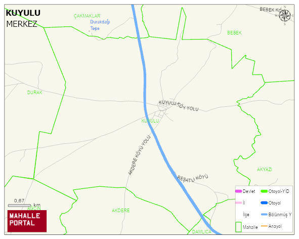
KUYULU Village Digital Map | All Neighbourhoods and Settlements
KUYULU Village – Population, Postal Code, Number of Workplaces
KUYULU village MERKEZ district of ADIYAMAN province. UAVT (National Address Database Code) Village Code: 598. Postal Code: 2010. KUYULU 3 streets and avenues, 112 independent business licensed apartments, 467 residential licensed apartments, 379 households. 1640 people live in this settlement. 845 male, 795 female. 60 and over is 222. The population rate of 60+ people is % 13 and the ratio of children under the age of 10 to the population is % 19
Leave a Comment