TOP 10: NÜFUS
Adana ilinde,
Yumurtalık ilçesinde, mahalleler içinde,
Kalabalığıyla öne çıkan listesinde 2. Kuzupınarı yer alır.
Hane nüfusunun en kalabalık olduğu listesinde 5. Kuzupınarı beşinci sırada konumlanan mahallelerden biridir.
İş potansiyeli en yüksek listesinde 4. Kuzupınarı yer alır.
Okuma-yazma oranı düşük bölgeler listesinde 5. Kuzupınarı kayıtlarda ilk beş içinde, 5. sıradadır.
Bankacılık noktaları en çok olan listesinde 5. Kuzupınarı istatistiksel olarak yer alır.
Çocuk sayısı bakımından lider listesinde 2. Kuzupınarı ikinci sırada yer almaktadır.
| Adi | KUZUPINARI Province Affiliated | ADANA District Affiliated | YUMURTALIK Postal code | 01682 Number of Streets | 4 Population Density km2-people | 44.39 Number of Apartments with business Licenses | 221 Number of Apartments with Residential Licenses | 704 Number of Households / Families | 479 Total Population | 1556 Male Population | 829 Woman Population | 727 Income Per Person - Spendable TL-Month | 9.064 |
|---|
KUZUPINARI Neighbourhood Map | Boundaries of Villages
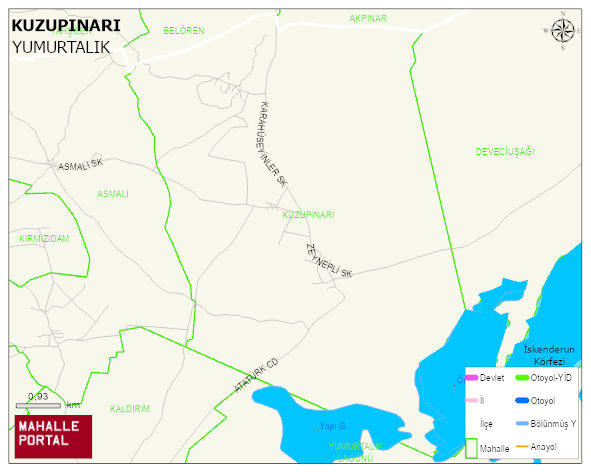
KUZUPINARI Neighbourhood Digital Map | Interactive Neighbourhoods
KUZUPINARI Neighbourhood – Population, Postal Code, Number of Workplaces
KUZUPINARI neighborhood is located in YUMURTALIK district of ADANA province. UAVT (National Address Database Code) Neighborhood Code: 177745. Postal Code: 1682. The population density is -per square kilometer- 43 people. KUZUPINARI 4 streets and avenues, 221 independent business licensed apartments, 688 residential licensed apartments, 464 households. 1543 people live in this settlement. 819 male, 724 female. 311 people have never married, 823 people are married, 26 people are divorced and 69 people have passed away. The number of people aged 60 and over is 287. The population rate of 60+ people is % 18 and the ratio of children under the age of 10 to the population is % 13 YUMURTALIK -in the district- 3. the most crowded neighbourhood.