ÖRENCIK Village Digital Map | Updated Neighbourhood Map
Bolu ilinde,
Mudurnu ilçesinde, köyler içinde,
Maddi refahı zirvede olan listesinde 3. Örencik üçüncü konumda bulunan mahalledir.
Hane yoğunluğu lider listesinde 2. Örencik 2. sırada olmasıyla dikkat çeker.
En çok işletmenin bulunduğu listesinde 2. Örencik sıralamada ikinci sırada yer almaktadır.
Rayiç bedeli zirvede listesinde 5. Örencik 5. sırada yer alarak üst beş içinde bulunmaktadır.
Banka ATM sayısı zirvede listesinde 5. Örencik 5. sırada kayıtlı ve dikkat çeken bir yerleşimdir.
65+ nüfusu en yoğun olan listesinde 4. Örencik kayıtlarda 4. sırada yer almaktadır.
| Adi | ÖRENCIK Province Affiliated | BOLU District Affiliated | MUDURNU Postal code | 14802 Number of Streets | 6 Population Density km2-people | 19.33 Number of Apartments with business Licenses | 98 Number of Apartments with Residential Licenses | 197 Number of Households / Families | 106 Total Population | 291 Male Population | 157 Woman Population | 134 Income Per Person - Spendable TL-Month | 8.705 |
|---|
ÖRENCIK Village Map | Terrain and Topography
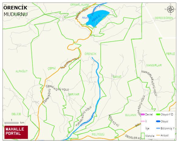
ÖRENCIK Village Digital Map | Updated Neighbourhood Map
ÖRENCIK Village – Population, Postal Code, Number of Workplaces
ÖRENCIK village MUDURNU district of BOLU province. UAVT (National Address Database Code) Village Code: 7012. Postal Code: 14802. ÖRENCIK 6 streets and avenues, 97 independent business licensed apartments, 197 residential licensed apartments, 106 households. 298 people live in this settlement. 155 male, 143 female. 60 and over is 98. The population rate of 60+ people is % 32
Leave a Comment