ORMANBAGI Village Digital Map | Geography and Natural Features
Siirt ilinde,
Şirvan ilçesinde, köyler içinde,
En kalabalık listesinde 3. Ormanbağı sıralamada üçüncü basamakta yer alır.
Kişi başı kazancı lider listesinde 5. Ormanbağı 5. sırada kayıtlı ve dikkat çeken bir yerleşimdir.
Aile sayısı bakımından zirvede listesinde 3. Ormanbağı sıralamada üçüncü sırada yer almaktadır.
Yapı stoğu en yüksek listesinde 3. Ormanbağı kayıtlarda üçüncü sırada gözükür.
Yükseköğretim düzeyi lider listesinde 3. Ormanbağı sıralamada üçüncü sırada yer almaktadır.
| Adi | ORMANBAGI Province Affiliated | SIIRT District Affiliated | SIRVAN Postal code | 56762 Number of Streets | 1 Population Density km2-people | 22.96 Number of Apartments with business Licenses | 5 Number of Apartments with Residential Licenses | 268 Number of Households / Families | 182 Total Population | 857 Male Population | 447 Woman Population | 410 Income Per Person - Spendable TL-Month | 4.804 |
|---|
ORMANBAGI Village Map | Satellite View and Local Boundaries
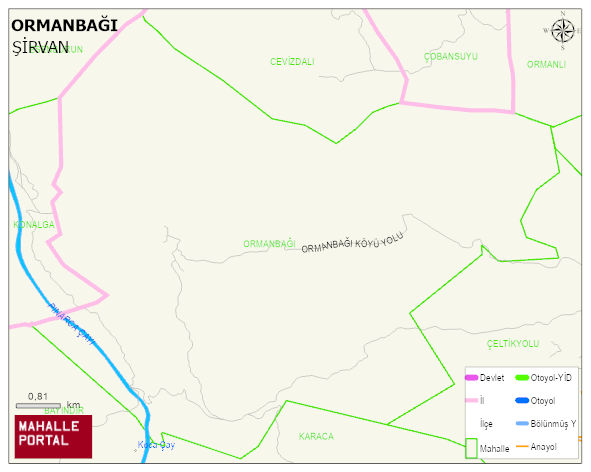
ORMANBAGI Village Digital Map | Geography and Natural Features
ORMANBAGI Village – Population, Postal Code, Number of Workplaces
ORMANBAGI village SIRVAN district of SIIRT province. UAVT (National Address Database Code) Village Code: 27993. Postal Code: 56762. ORMANBAGI 1 streets and avenues, 5 independent business licensed apartments, 261 residential licensed apartments, 178 households. 888 people live in this settlement. 467 male, 421 female. 60 and over is 75. The population rate of 60+ people is % 8 and the ratio of children under the age of 10 to the population is % 16 SIRVAN -in the district- 4. the most crowded neighbourhood.
Leave a Comment