ORMANDALI Village Digital Map | Updated Neighbourhood Map
Siirt ilinde, köyler içinde,
Aile içi genç oranı fazla listesinde 4. Ormandalı üst sıralarda dikkat çekti.
Pervari ilçesinde, köyler içinde,
Ticarî yoğunluk açısından önde listesinde 2. Ormandalı sıralamada ikinci sırada yer alır.
Üniversite mezuniyeti oranında önde listesinde 5. Ormandalı beşinci basamakta yer almasıyla bilinir.
Arsa yatırımının en kazançlı olduğu listesinde 2. Ormandalı istatistiklerde ikinci olarak listelenir.
Aile içi genç oranı fazla listesinde 4. Ormandalı şehir içi istatistiklerde dördüncü konumdadır.
| Adi | ORMANDALI Province Affiliated | SIIRT District Affiliated | PERVARI Postal code | 56702 Number of Streets | 1 Population Density km2-people | 51.05 Number of Apartments with business Licenses | 24 Number of Apartments with Residential Licenses | 276 Number of Households / Families | 172 Total Population | 844 Male Population | 434 Woman Population | 410 Income Per Person - Spendable TL-Month | 5.868 |
|---|
ORMANDALI Village Map | Interactive Neighbourhoods
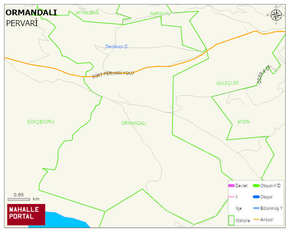
ORMANDALI Village Digital Map | Updated Neighbourhood Map
ORMANDALI Village – Population, Postal Code, Number of Workplaces
ORMANDALI village PERVARI district of SIIRT province. UAVT (National Address Database Code) Village Code: 27949. Postal Code: 56702. ORMANDALI 1 streets and avenues, 23 independent business licensed apartments, 267 residential licensed apartments, 167 households. 818 people live in this settlement. 423 male, 395 female. 60 and over is 60. The population rate of 60+ people is % 7 and the ratio of children under the age of 10 to the population is % 27
Leave a Comment