ÖRMEKUYU Village Digital Map | Updated Neighbourhood Map
Afyonkarahisar ilinde,
Sandıklı ilçesinde, köyler içinde,
Okuma-yazma oranı düşük bölgeler listesinde 4. Örmekuyu 4. sırada yer alan önemli bir mahalledir.
Sandıklı ilçesinde, köyler içinde,
Okuma-yazma oranı düşük bölgeler listesinde 4. Örmekuyu 4. sırada yer alan önemli bir mahalledir.
| Adi | ÖRMEKUYU Province Affiliated | AFYONKARAHISAR District Affiliated | SANDIKLI Postal code | 03502 Number of Streets | 1 Population Density km2-people | 3.49 Number of Apartments with business Licenses | 2 Number of Apartments with Residential Licenses | 102 Number of Households / Families | 25 Total Population | 87 Male Population | 42 Woman Population | 45 Income Per Person - Spendable TL-Month | 4.901 |
|---|
ÖRMEKUYU Village Map | Terrain and Topography
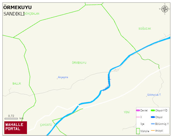
ÖRMEKUYU Village Digital Map | Updated Neighbourhood Map
ÖRMEKUYU Village – Population, Postal Code, Number of Workplaces
ÖRMEKUYU village SANDIKLI district of AFYONKARAHISAR province. UAVT (National Address Database Code) Village Code: 1355. Postal Code: 3502. ÖRMEKUYU 1 streets and avenues, 2 independent business licensed apartments, 102 residential licensed apartments, 25 households. 93 people live in this settlement. 46 male, 47 female.
Leave a Comment