TOP 10: NÜFUS
İstanbul ilinde,
Kağıthane ilçesinde, mahalleler içinde,
En fazla üniversite mezunu barındıran listesinde 2. Ortabayır şehir içi sıralamada 2. sıradadır.
Toprak birim fiyatı en yüksek listesinde 3. Ortabayır istatistik listelerinde üçüncü sıralamaya sahiptir.
Evlilik yapmayanların en çok olduğu listesinde 3. Ortabayır sıralamada üçüncü sırada yer almaktadır.
Yaş alan bireylerin yoğun yaşadığı listesinde 1. Ortabayır yer alır.
| Adi | ORTABAYIR Province Affiliated | ISTANBUL District Affiliated | KAGITHANE Postal code | 34413 Number of Streets | 117 Population Density km2-people | 59231.97 Number of Apartments with business Licenses | 1514 Number of Apartments with Residential Licenses | 10581 Number of Households / Families | 8038 Total Population | 22073 Male Population | 10744 Woman Population | 11329 Income Per Person - Spendable TL-Month | 24.190 |
|---|
ORTABAYIR Neighbourhood Map | Updated Neighbourhood Map
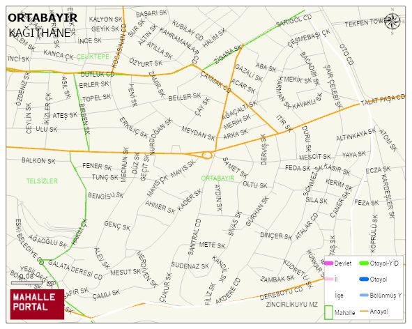
ORTABAYIR Neighbourhood Digital Map | Mountains, Rivers and Elevation Details
ORTABAYIR Neighbourhood – Population, Postal Code, Number of Workplaces
ORTABAYIR neighborhood is located in KAGITHANE district of ISTANBUL province. UAVT (National Address Database Code) Neighborhood Code: 40546. Postal Code: 34413. The population density is -per square kilometer- 59098 people. ORTABAYIR 117 streets and avenues, 1526 independent business licensed apartments, 10555 residential licensed apartments, 8006 households. 22039 people live in this settlement. 10744 male, 11295 female. 7453 people have never married, 9636 people are married, 1161 people are divorced and 927 people have passed away. The number of people aged 60 and over is 3104. The population rate of 60+ people is % 14 and the ratio of children under the age of 10 to the population is % 8