ÖRTÜLÜCE Village Digital Map | Updated Neighbourhood Map
Çanakkale ilinde,
Biga ilçesinde, köyler içinde,
En fazla nüfus barındıran listesinde 3. Örtülüce sıralamada üçüncü sırada yer almaktadır.
Hane yoğunluğu lider listesinde 4. Örtülüce sıralamada dördüncü sıradadır.
Rayiç bedeli zirvede listesinde 1. Örtülüce istatistiklere göre en üst sıradadır.
En çok çocuklu ailelerin yaşadığı listesinde 4. Örtülüce sıralamada dördüncülük pozisyonundadır.
| Adi | ÖRTÜLÜCE Province Affiliated | ÇANAKKALE District Affiliated | BIGA Postal code | 17950 Number of Streets | 1 Population Density km2-people | 34.03 Number of Apartments with business Licenses | 60 Number of Apartments with Residential Licenses | 601 Number of Households / Families | 379 Total Population | 1167 Male Population | 592 Woman Population | 575 Income Per Person - Spendable TL-Month | 8.306 |
|---|
ÖRTÜLÜCE Village Map | Terrain and Topography
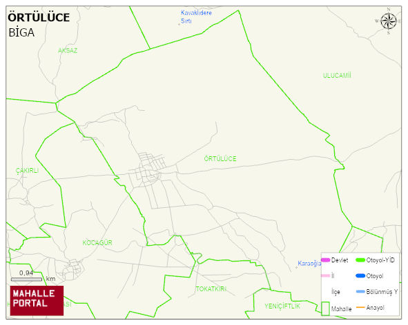
ÖRTÜLÜCE Village Digital Map | Updated Neighbourhood Map
ÖRTÜLÜCE Village – Population, Postal Code, Number of Workplaces
ÖRTÜLÜCE village BIGA district of ÇANAKKALE province. UAVT (National Address Database Code) Village Code: 8302. Postal Code: 17950. ÖRTÜLÜCE 1 streets and avenues, 56 independent business licensed apartments, 598 residential licensed apartments, 385 households. 1191 people live in this settlement. 602 male, 589 female. 187 people have never married, 706 people are married, 23 people are divorced and 95 people have passed away. The number of people aged 60 and over is 300. The population rate of 60+ people is % 25 and the ratio of children under the age of 10 to the population is % 8
Leave a Comment