ORUÇBEY Village Digital Map | Boundaries of Villages
Osmaniye ilinde, köyler içinde,
Eğitim durumunun zayıf olduğu listesinde 3. Oruçbey rekabetin içinde güçlü bir konumda.
Kadirli ilçesinde, köyler içinde,
Eğitim durumunun zayıf olduğu listesinde 3. Oruçbey 3. sırada olup üst sıralara yakın bir konumdadır.
Yalnız kalan yetişkin oranı yüksek listesinde 3. Oruçbey 3. sırada kayıtlı ve öne çıkan bir alandır.
| Adi | ORUÇBEY Province Affiliated | OSMANIYE District Affiliated | KADIRLI Postal code | 80752 Number of Streets | 4 Population Density km2-people | 20.30 Number of Apartments with business Licenses | 4 Number of Apartments with Residential Licenses | 636 Number of Households / Families | 160 Total Population | 386 Male Population | 194 Woman Population | 192 Income Per Person - Spendable TL-Month | 4.988 |
|---|
ORUÇBEY Village Map | Mountains, Rivers and Elevation Details
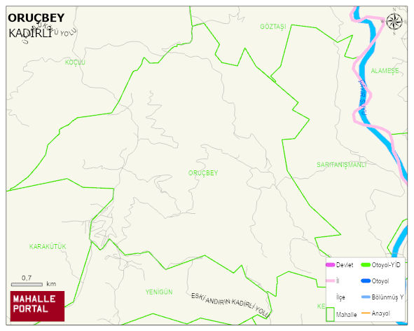
ORUÇBEY Village Digital Map | Boundaries of Villages
ORUÇBEY Village – Population, Postal Code, Number of Workplaces
ORUÇBEY village KADIRLI district of OSMANIYE province. UAVT (National Address Database Code) Village Code: 37284. Postal Code: 80752. ORUÇBEY 4 streets and avenues, 4 independent business licensed apartments, 636 residential licensed apartments, 169 households. 455 people live in this settlement. 231 male, 224 female. 60 and over is 135. The population rate of 60+ people is % 29 and the ratio of children under the age of 10 to the population is % 5
Leave a Comment