ORUÇBEYLI Village Digital Map | Mountains, Rivers and Elevation Details
Bayburt ilinde, köyler içinde,
Çocuk nüfusu en yüksek listesinde 5. Oruçbeyli zirveye en yakın grupta yer alıyor.
Merkez ilçesinde, köyler içinde,
En yüksek gelir seviyesine sahip listesinde 5. Oruçbeyli sıralamada beşinci sırada yer almaktadır.
Çocuk nüfusu en yüksek listesinde 5. Oruçbeyli sıralamada beşinci sırada yer almaktadır.
| Adi | ORUÇBEYLI Province Affiliated | BAYBURT District Affiliated | MERKEZ Postal code | 69002 Number of Streets | 1 Population Density km2-people | 14.62 Number of Apartments with business Licenses | 7 Number of Apartments with Residential Licenses | 185 Number of Households / Families | 81 Total Population | 295 Male Population | 150 Woman Population | 145 Income Per Person - Spendable TL-Month | 7.796 |
|---|
ORUÇBEYLI Village Map | Geography and Natural Features
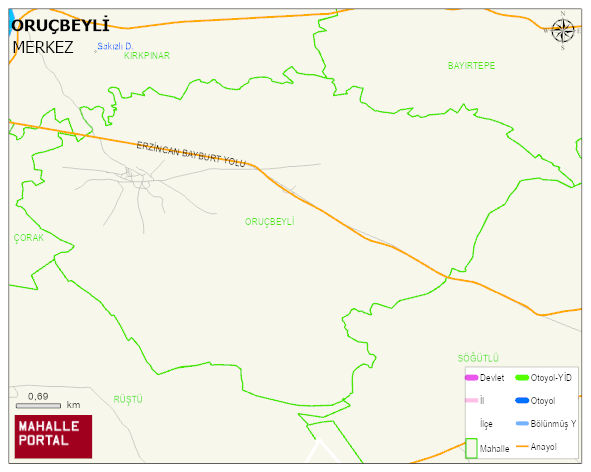
ORUÇBEYLI Village Digital Map | Mountains, Rivers and Elevation Details
ORUÇBEYLI Village – Population, Postal Code, Number of Workplaces
ORUÇBEYLI village MERKEZ district of BAYBURT province. UAVT (National Address Database Code) Village Code: 34981. Postal Code: 69002. ORUÇBEYLI 1 streets and avenues, 7 independent business licensed apartments, 183 residential licensed apartments, 86 households. 308 people live in this settlement. 160 male, 148 female. 60 and over is 71. The population rate of 60+ people is % 23 and the ratio of children under the age of 10 to the population is % 7
Leave a Comment