TOP 10: NÜFUS
Çanakkale ilinde,
Çan ilçesinde, mahalleler içinde,
Eğitim imkanlarının sınırlı olduğu listesinde 4. Osmanefendi 4. sırada kayıtlı, bölgenin önde gelen yerleşimlerinden biridir.
Hayat arkadaşını kaybedenlerin yoğun olduğu listesinde 3. Osmanefendi istatistiksel sıralamada üçüncü basamakta bulunur.
Yaş alan bireylerin yoğun yaşadığı listesinde 4. Osmanefendi 4. sırada konumlanmış, öne çıkan bir yerleşimdir.
| Adi | OSMANEFENDI Province Affiliated | ÇANAKKALE District Affiliated | ÇAN Postal code | 17400 Number of Streets | 33 Population Density km2-people | 945.48 Number of Apartments with business Licenses | 13 Number of Apartments with Residential Licenses | 1151 Number of Households / Families | 657 Total Population | 1727 Male Population | 866 Woman Population | 861 Income Per Person - Spendable TL-Month | 13.876 |
|---|
OSMANEFENDI Neighbourhood Map | Boundaries of Villages
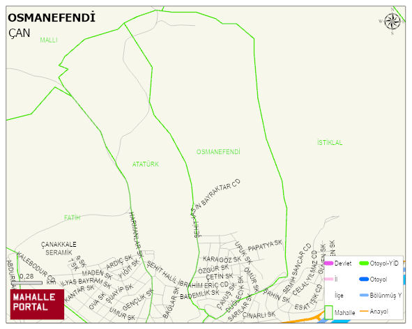
OSMANEFENDI Neighbourhood Digital Map | Mountains, Rivers and Elevation Details
OSMANEFENDI Neighbourhood – Population, Postal Code, Number of Workplaces
OSMANEFENDI neighborhood is located in ÇAN district of ÇANAKKALE province. UAVT (National Address Database Code) Neighborhood Code: 20146. Postal Code: 17400. The population density is -per square kilometer- 957 people. OSMANEFENDI 33 streets and avenues, 12 independent business licensed apartments, 1147 residential licensed apartments, 668 households. 1749 people live in this settlement. 882 male, 867 female. 270 people have never married, 1072 people are married, 48 people are divorced and 94 people have passed away. The number of people aged 60 and over is 410. The population rate of 60+ people is % 23 and the ratio of children under the age of 10 to the population is % 9 ÇAN -in the district- 6. the most crowded neighbourhood.