OTLUK Village Digital Map | Mountains, Rivers and Elevation Details
Sivas ilinde,
Şarkışla ilçesinde, köyler içinde,
A+ ve A gelir grubunun en yoğun olduğu listesinde 4. Otluk 4. sırada konumlanmış, öne çıkan bir yerleşimdir.
Şarkışla ilçesinde, köyler içinde,
A+ ve A gelir grubunun en yoğun olduğu listesinde 4. Otluk 4. sırada konumlanmış, öne çıkan bir yerleşimdir.
| Adi | OTLUK Province Affiliated | SIVAS District Affiliated | SARKISLA Postal code | 58402 Number of Streets | 1 Population Density km2-people | 4.84 Number of Apartments with business Licenses | 0 Number of Apartments with Residential Licenses | 58 Number of Households / Families | 18 Total Population | 43 Male Population | 22 Woman Population | 21 Income Per Person - Spendable TL-Month | 5.117 |
|---|
OTLUK Village Map | Satellite View and Local Boundaries
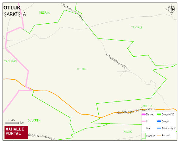
OTLUK Village Digital Map | Mountains, Rivers and Elevation Details
OTLUK Village – Population, Postal Code, Number of Workplaces
OTLUK village SARKISLA district of SIVAS province. UAVT (National Address Database Code) Village Code: 29472. Postal Code: 58402. OTLUK 1 streets and avenues, 42 residential licensed apartments, 23 households. 79 people live in this settlement. 42 male, 37 female.
Leave a Comment