OYALI Village Digital Map | Updated Neighbourhood Map
Şırnak ilinde,
İdil ilçesinde, köyler içinde,
Nüfus bakımından önde gelen listesinde 3. Oyalı sıralamada üçüncü sırada yer almaktadır.
Hane adedi bakımından ilk sırada listesinde 2. Oyalı istatistiklere göre 2. sıradadır.
En çok yerleşim birimi barındıran listesinde 2. Oyalı sıralamada ikinci sırada yer almaktadır.
Ekonomik faaliyetlerin merkezi listesinde 3. Oyalı üçüncü konumda bulunan mahalledir.
| Adi | OYALI Province Affiliated | SIRNAK District Affiliated | IDIL Postal code | 73302 Number of Streets | 1 Population Density km2-people | 75.03 Number of Apartments with business Licenses | 29 Number of Apartments with Residential Licenses | 553 Number of Households / Families | 324 Total Population | 2121 Male Population | 1081 Woman Population | 1040 Income Per Person - Spendable TL-Month | 5.159 |
|---|
OYALI Village Map | Terrain and Topography
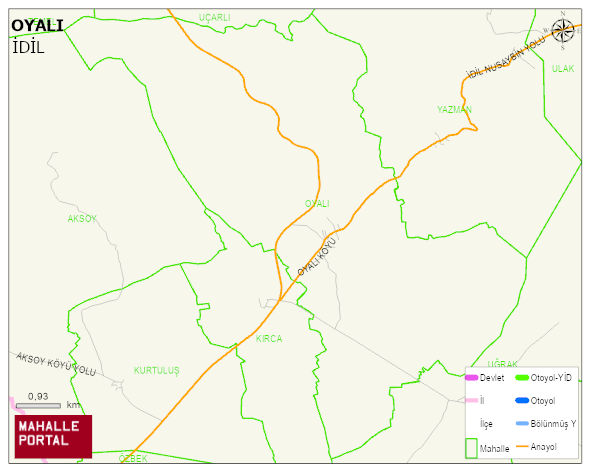
OYALI Village Digital Map | Updated Neighbourhood Map
OYALI Village – Population, Postal Code, Number of Workplaces
OYALI village IDIL district of SIRNAK province. UAVT (National Address Database Code) Village Code: 35927. Postal Code: 73302. OYALI 1 streets and avenues, 27 independent business licensed apartments, 543 residential licensed apartments, 325 households. 2165 people live in this settlement. 1086 male, 1079 female. 60 and over is 149. The population rate of 60+ people is % 6 and the ratio of children under the age of 10 to the population is % 24 IDIL -in the district- 8. the most crowded neighbourhood.
Leave a Comment