TOP 10: NÜFUS
Balıkesir ilinde,
Bandırma ilçesinde, mahalleler içinde,
Nüfus açısından zirvede yer alan listesinde 4. Paşabayır yer alır.
Aile yaşamının en yoğun olduğu listesinde 2. Paşabayır 2. sırada, bölgenin önde gelen yerleşimlerinden biridir.
Konut kapasitesi en geniş listesinde 2. Paşabayır ikinci sırada yer almaktadır.
ATM varlığı bakımından ilk sırada listesinde 3. Paşabayır sıralamada üçüncü sırada yer almaktadır.
| Adi | PASABAYIR Province Affiliated | BALIKESIR District Affiliated | BANDIRMA Postal code | 10200 Number of Streets | 67 Population Density km2-people | 15558.33 Number of Apartments with business Licenses | 575 Number of Apartments with Residential Licenses | 7581 Number of Households / Families | 5766 Total Population | 14330 Male Population | 7097 Woman Population | 7233 Income Per Person - Spendable TL-Month | 26.128 |
|---|
PASABAYIR Neighbourhood Map | Interactive Neighbourhoods
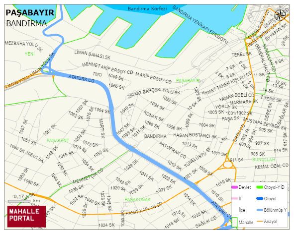
PASABAYIR Neighbourhood Digital Map | Terrain and Topography
PASABAYIR Neighbourhood – Population, Postal Code, Number of Workplaces
PASABAYIR neighborhood is located in BANDIRMA district of BALIKESIR province. UAVT (National Address Database Code) Neighborhood Code: 10396. Postal Code: 10200. The population density is -per square kilometer- 15421 people. PASABAYIR 62 streets and avenues, 536 independent business licensed apartments, 7532 residential licensed apartments, 5769 households. 14203 people live in this settlement. 7013 male, 7190 female. 2967 people have never married, 7364 people are married, 797 people are divorced and 988 people have passed away. The number of people aged 60 and over is 3195. The population rate of 60+ people is % 22 and the ratio of children under the age of 10 to the population is % 9 BANDIRMA -in the district- 4. the most crowded neighbourhood.