TOP 10: NÜFUS
Balıkesir ilinde, mahalleler içinde,
Lisans ve üstü mezun oranı zirvede listesinde 2. Paşakent üst sıralarda yer aldı.
Bandırma ilçesinde, mahalleler içinde,
Ekonomik gücü en yüksek listesinde 3. Paşakent istatistik listelerinde üçüncü sıralamaya sahiptir.
Lisans ve üstü mezun oranı zirvede listesinde 1. Paşakent sıralamada en üstte yer almaktadır.
Zengin sayısı bakımından lider listesinde 1. Paşakent birinci konumda, en üstte bulunan mahalledir.
| Adi | PASAKENT Province Affiliated | BALIKESIR District Affiliated | BANDIRMA Postal code | 10200 Number of Streets | 57 Population Density km2-people | 9386.16 Number of Apartments with business Licenses | 327 Number of Apartments with Residential Licenses | 5181 Number of Households / Families | 3751 Total Population | 10437 Male Population | 5053 Woman Population | 5384 Income Per Person - Spendable TL-Month | 32.167 |
|---|
PASAKENT Neighbourhood Map | Satellite View and Local Boundaries
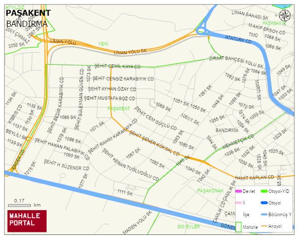
PASAKENT Neighbourhood Digital Map | Mountains, Rivers and Elevation Details
PASAKENT Neighbourhood – Population, Postal Code, Number of Workplaces
PASAKENT neighborhood is located in BANDIRMA district of BALIKESIR province. UAVT (National Address Database Code) Neighborhood Code: 10404. Postal Code: 10200. The population density is -per square kilometer- 9224 people. PASAKENT 52 streets and avenues, 304 independent business licensed apartments, 5027 residential licensed apartments, 3654 households. 10257 people live in this settlement. 4982 male, 5275 female. 1513 people have never married, 5746 people are married, 359 people are divorced and 315 people have passed away. The number of people aged 60 and over is 1369. The population rate of 60+ people is % 13 and the ratio of children under the age of 10 to the population is % 14 BANDIRMA -in the district- 7. the most crowded neighbourhood.