| Adi | SAGLIK Province Affiliated | ANKARA District Affiliated | ÇANKAYA Postal code | 06420 Number of Streets | 14 Population Density km2-people | 2328.07 Number of Apartments with business Licenses | 875 Number of Apartments with Residential Licenses | 463 Number of Households / Families | 307 Total Population | 571 Male Population | 346 Woman Population | 225 Income Per Person - Spendable TL-Month | 41.753 |
|---|
SAGLIK Neighbourhood Map | Mountains, Rivers and Elevation Details
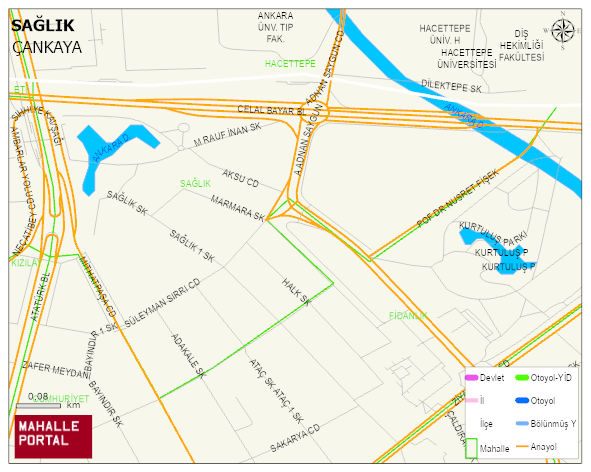
SAGLIK Neighbourhood Digital Map | Updated Neighbourhood Map
SAGLIK Neighbourhood – Population, Postal Code, Number of Workplaces
SAGLIK neighborhood is located in ÇANKAYA district of ANKARA province. UAVT (National Address Database Code) Neighborhood Code: 1597. Postal Code: 6420. The population density is -per square kilometer- 2402 people. SAGLIK 14 streets and avenues, 876 independent business licensed apartments, 459 residential licensed apartments, 295 households. 589 people live in this settlement. 368 male, 221 female. 275 people have never married, 178 people are married, 91 people are divorced and 16 people have passed away. The number of people aged 60 and over is 104. The population rate of 60+ people is % 17
Leave a Comment