TOP 10: NÜFUS
İstanbul ilinde,
Bağcılar ilçesinde, mahalleler içinde,
Lisans ve üstü mezun oranı zirvede listesinde 4. Sancaktepe istatistiklere göre 4. sırada yer alır.
M² arsa değerinin en çok olduğu listesinde 2. Sancaktepe şehir içi sıralamada 2. sıradadır.
Yalnız kalan yetişkin oranı yüksek listesinde 3. Sancaktepe listede üçüncü basamakta konumlanmıştır.
Kıdemli nüfusun en çok olduğu listesinde 5. Sancaktepe listede 5. sırada yer alır.
| Adi | SANCAKTEPE Province Affiliated | ISTANBUL District Affiliated | BAGCILAR Postal code | 34200 Number of Streets | 83 Population Density km2-people | 48334.34 Number of Apartments with business Licenses | 1239 Number of Apartments with Residential Licenses | 6480 Number of Households / Families | 5281 Total Population | 19196 Male Population | 9541 Woman Population | 9655 Income Per Person - Spendable TL-Month | 24.841 |
|---|
SANCAKTEPE Neighbourhood Map | All Neighbourhoods and Settlements
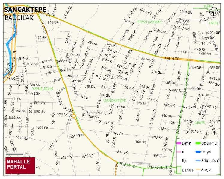
SANCAKTEPE Neighbourhood Digital Map | Updated Neighbourhood Map
SANCAKTEPE Neighbourhood – Population, Postal Code, Number of Workplaces
SANCAKTEPE neighborhood is located in BAGCILAR district of ISTANBUL province. UAVT (National Address Database Code) Neighborhood Code: 40164. Postal Code: 34200. The population density is -per square kilometer- 48463 people. SANCAKTEPE 83 streets and avenues, 1250 independent business licensed apartments, 6475 residential licensed apartments, 5266 households. 19260 people live in this settlement. 9619 male, 9641 female. 4659 people have never married, 8981 people are married, 725 people are divorced and 652 people have passed away. The number of people aged 60 and over is 1957. The population rate of 60+ people is % 10 and the ratio of children under the age of 10 to the population is % 13