TOP 10: NÜFUS
İstanbul ilinde,
Ümraniye ilçesinde, mahalleler içinde,
Kişi başı kazancı lider listesinde 4. Şerifali yer alır.
Ticari hayatın en yoğun olduğu listesinde 5. Şerifali sıralamada beşinci sırada yer almaktadır.
Yükseköğretim düzeyi lider listesinde 3. Şerifali sıralamada üçüncü sırada yer almaktadır.
En fazla yüksek gelirli yaşayan listesinde 5. Şerifali sıralamada beşinci sırada yer almaktadır.
| Adi | SERIFALI Province Affiliated | ISTANBUL District Affiliated | ÜMRANIYE Postal code | 34775 Number of Streets | 46 Population Density km2-people | 7737.22 Number of Apartments with business Licenses | 2571 Number of Apartments with Residential Licenses | 4860 Number of Households / Families | 3193 Total Population | 9495 Male Population | 4823 Woman Population | 4672 Income Per Person - Spendable TL-Month | 27.244 |
|---|
SERIFALI Neighbourhood Map | Boundaries of Villages
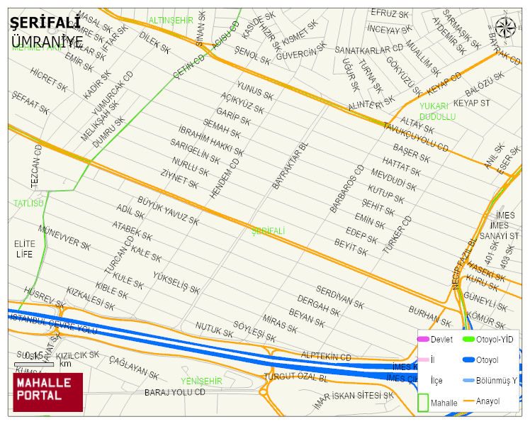
SERIFALI Neighbourhood Digital Map | Detailed Villages and Neighbourhoods
SERIFALI Neighbourhood – Population, Postal Code, Number of Workplaces
SERIFALI neighborhood is located in ÜMRANIYE district of ISTANBUL province. UAVT (National Address Database Code) Neighborhood Code: 98703. Postal Code: 34775. The population density is -per square kilometer- 7738 people. SERIFALI 46 streets and avenues, 2542 independent business licensed apartments, 4801 residential licensed apartments, 3191 households. 9502 people live in this settlement. 4842 male, 4660 female. 2163 people have never married, 4567 people are married, 527 people are divorced and 239 people have passed away. The number of people aged 60 and over is 905. The population rate of 60+ people is % 9 and the ratio of children under the age of 10 to the population is % 14