SEYITHANBEY Village Digital Map | Mountains, Rivers and Elevation Details
Ağrı ilinde,
Hamur ilçesinde, köyler içinde,
İş potansiyeli en yüksek listesinde 1. Seyithanbey birinci konumda, en üstte bulunan mahalledir.
Yaşça büyük nüfus oranı yüksek listesinde 2. Seyithanbey istatistiklerde ikinci olarak listelenir.
Hamur ilçesinde, köyler içinde,
İş potansiyeli en yüksek listesinde 1. Seyithanbey birinci konumda, en üstte bulunan mahalledir.
Yaşça büyük nüfus oranı yüksek listesinde 2. Seyithanbey istatistiklerde ikinci olarak listelenir.
| Adi | SEYITHANBEY Province Affiliated | AGRI District Affiliated | HAMUR Postal code | 04852 Number of Streets | 2 Population Density km2-people | 31.96 Number of Apartments with business Licenses | 25 Number of Apartments with Residential Licenses | 124 Number of Households / Families | 106 Total Population | 537 Male Population | 273 Woman Population | 264 Income Per Person - Spendable TL-Month | 3.588 |
|---|
SEYITHANBEY Village Map | Detailed Villages and Neighbourhoods
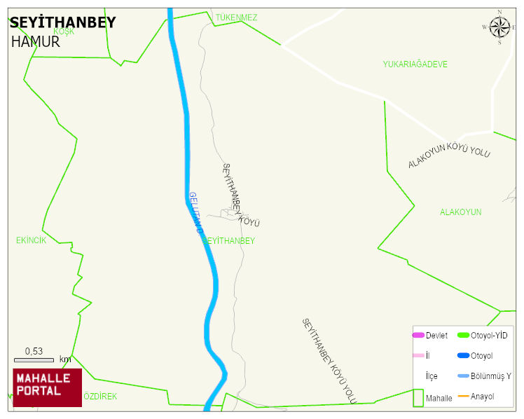
SEYITHANBEY Village Digital Map | Mountains, Rivers and Elevation Details
SEYITHANBEY Village – Population, Postal Code, Number of Workplaces
SEYITHANBEY village HAMUR district of AGRI province. UAVT (National Address Database Code) Village Code: 1825. Postal Code: 4852. SEYITHANBEY 2 streets and avenues, 25 independent business licensed apartments, 123 residential licensed apartments, 106 households. 549 people live in this settlement. 283 male, 266 female. 60 and over is 64. The population rate of 60+ people is % 11 and the ratio of children under the age of 10 to the population is % 18
Leave a Comment