TOP 10: NÜFUS
İzmir ilinde,
Çiğli ilçesinde, mahalleler içinde,
Eğitim seviyesinde alt sıralarda listesinde 4. Şirintepe 4. sırada yer alarak üst sıralara yakın bir konumdadır.
Para çekme noktalarının merkezi listesinde 4. Şirintepe 4. sırada kayıtlı, bölgenin önde gelen yerleşimlerinden biridir.
Sokak bakımından en kalabalık listesinde 5. Şirintepe kayıtlarda ilk beş içinde, 5. sıradadır.
| Adi | SIRINTEPE Province Affiliated | IZMIR District Affiliated | ÇIGLI Postal code | 35640 Number of Streets | 97 Population Density km2-people | 14072.39 Number of Apartments with business Licenses | 364 Number of Apartments with Residential Licenses | 4635 Number of Households / Families | 3059 Total Population | 8433 Male Population | 4301 Woman Population | 4132 Income Per Person - Spendable TL-Month | 19.050 |
|---|
SIRINTEPE Neighbourhood Map | Detailed Villages and Neighbourhoods
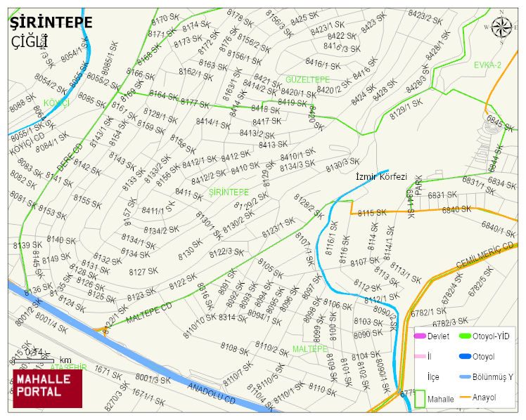
SIRINTEPE Neighbourhood Digital Map | All Neighbourhoods and Settlements
SIRINTEPE Neighbourhood – Population, Postal Code, Number of Workplaces
SIRINTEPE neighborhood is located in ÇIGLI district of IZMIR province. UAVT (National Address Database Code) Neighborhood Code: 41067. Postal Code: 35640. The population density is -per square kilometer- 14211 people. SIRINTEPE 96 streets and avenues, 363 independent business licensed apartments, 4146 residential licensed apartments, 3064 households. 8512 people live in this settlement. 4339 male, 4173 female. 2041 people have never married, 3991 people are married, 715 people are divorced and 498 people have passed away. The number of people aged 60 and over is 1443. The population rate of 60+ people is % 16 and the ratio of children under the age of 10 to the population is % 9 ÇIGLI -in the district- 8. the most crowded neighbourhood.