TOP 10: NÜFUS
Siirt ilinde,
Kurtalan ilçesinde, mahalleler içinde,
Esnaf–işletme sayısı lider listesinde 4. Sümer yer alır.
M² arsa değerinin en çok olduğu listesinde 5. Sümer sıralamada beşinci sırada yer almaktadır.
Bekâr oranı zirvede listesinde 1. Sümer 1. sırada, bölgenin en önde gelen yerleşimidir.
Sokak dokusu zengin bölgeler listesinde 5. Sümer sıralamada beşinci sırada yer almaktadır.
| Adi | SÜMER Province Affiliated | SIIRT District Affiliated | KURTALAN Postal code | 56500 Number of Streets | 35 Population Density km2-people | 3979.34 Number of Apartments with business Licenses | 233 Number of Apartments with Residential Licenses | 877 Number of Households / Families | 585 Total Population | 2647 Male Population | 1373 Woman Population | 1274 Income Per Person - Spendable TL-Month | 9.560 |
|---|
SÜMER Neighbourhood Map | All Neighbourhoods and Settlements
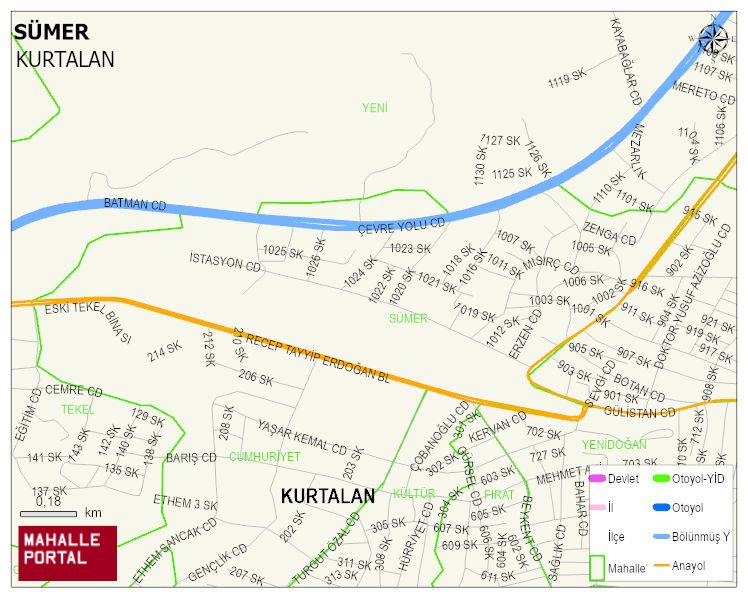
SÜMER Neighbourhood Digital Map | Terrain and Topography
SÜMER Neighbourhood – Population, Postal Code, Number of Workplaces
SÜMER neighborhood is located in KURTALAN district of SIIRT province. UAVT (National Address Database Code) Neighborhood Code: 70174. Postal Code: 56500. The population density is -per square kilometer- 4090 people. SÜMER 35 streets and avenues, 228 independent business licensed apartments, 882 residential licensed apartments, 597 households. 2720 people live in this settlement. 1394 male, 1326 female. 843 people have never married, 1001 people are married, 25 people are divorced and 67 people have passed away. The number of people aged 60 and over is 233. The population rate of 60+ people is % 8 and the ratio of children under the age of 10 to the population is % 19 KURTALAN -in the district- 6. the most crowded neighbourhood.