TASKESEN Village Digital Map | Satellite View and Local Boundaries
Ağrı ilinde,
Diyadin ilçesinde, köyler içinde,
Nüfusu en fazla listesinde 2. Taşkesen ikinci sırada olup üst sıralarda yer alır.
En geniş aile yerleşimi listesinde 2. Taşkesen sıralamada ikinci sırada yer almaktadır.
Mesken sayısı bakımından öne çıkan listesinde 3. Taşkesen şehir içi sıralamada 3. sıradadır.
Üniversite mezuniyeti oranında önde listesinde 4. Taşkesen sıralamada dördüncü sıradadır.
Banka ATM’lerinde lider konumda listesinde 3. Taşkesen sıralamada üçüncü konumda dikkat çeker.
Üst yaş grubunda lider listesinde 4. Taşkesen dördüncü sırada bulunmasıyla dikkat çeker.
| Adi | TASKESEN Province Affiliated | AGRI District Affiliated | DIYADIN Postal code | 04902 Number of Streets | 2 Population Density km2-people | 49.69 Number of Apartments with business Licenses | 2 Number of Apartments with Residential Licenses | 236 Number of Households / Families | 173 Total Population | 765 Male Population | 398 Woman Population | 367 Income Per Person - Spendable TL-Month | 3.165 |
|---|
TASKESEN Village Map | Interactive Neighbourhoods
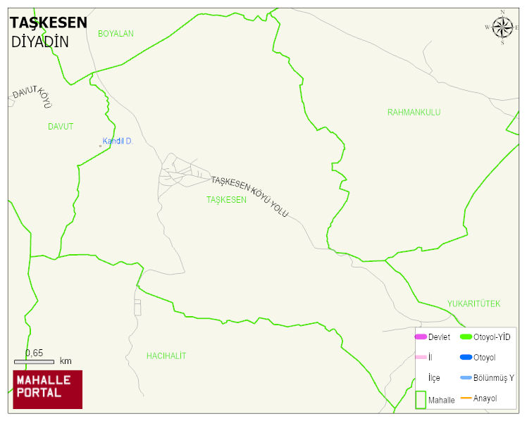
TASKESEN Village Digital Map | Satellite View and Local Boundaries
TASKESEN Village – Population, Postal Code, Number of Workplaces
TASKESEN village DIYADIN district of AGRI province. UAVT (National Address Database Code) Village Code: 1619. Postal Code: 4902. TASKESEN 2 streets and avenues, 2 independent business licensed apartments, 236 residential licensed apartments, 180 households. 802 people live in this settlement. 429 male, 373 female. 60 and over is 79. The population rate of 60+ people is % 9 and the ratio of children under the age of 10 to the population is % 24
Leave a Comment