TASOLUK Village Digital Map | Mountains, Rivers and Elevation Details
Muş ilinde, köyler içinde,
M² arsa değerinin en çok olduğu listesinde 4. Taşoluk yüksek gelir kategorisinde yer aldı.
Merkez ilçesinde, köyler içinde,
M² arsa değerinin en çok olduğu listesinde 4. Taşoluk istatistik listelerinde 4. sıradadır.
ATM yoğunluğu en yüksek listesinde 3. Taşoluk 3. sırada kayıtlı olan önemli bir yerleşimdir.
| Adi | TASOLUK Province Affiliated | MUS District Affiliated | MERKEZ Postal code | 49250 Number of Streets | 2 Population Density km2-people | 38.75 Number of Apartments with business Licenses | 25 Number of Apartments with Residential Licenses | 371 Number of Households / Families | 262 Total Population | 1512 Male Population | 808 Woman Population | 704 Income Per Person - Spendable TL-Month | 9.481 |
|---|
TASOLUK Village Map | Geography and Natural Features
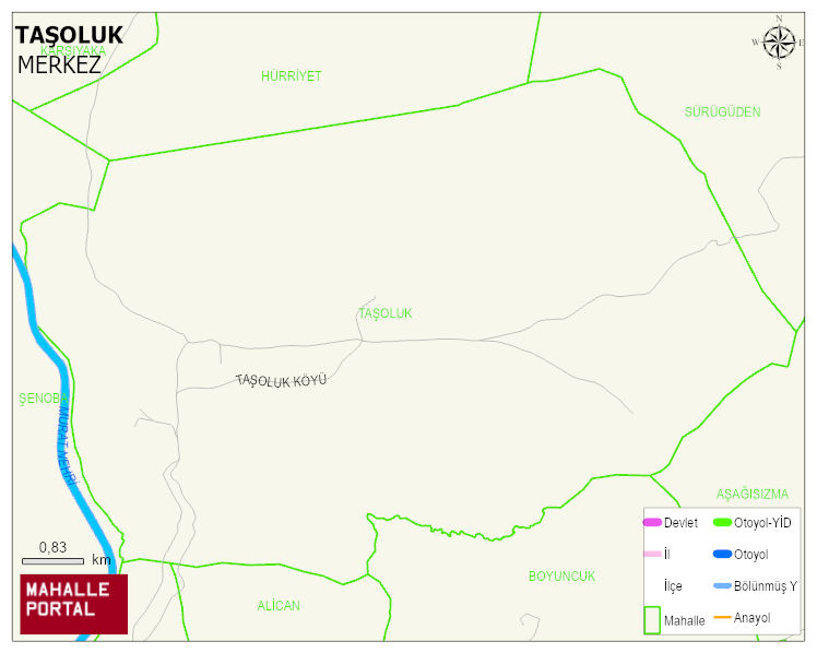
TASOLUK Village Digital Map | Mountains, Rivers and Elevation Details
TASOLUK Village – Population, Postal Code, Number of Workplaces
TASOLUK village MERKEZ district of MUS province. UAVT (National Address Database Code) Village Code: 24704. Postal Code: 49250. TASOLUK 2 streets and avenues, 22 independent business licensed apartments, 361 residential licensed apartments, 264 households. 1568 people live in this settlement. 827 male, 741 female. 60 and over is 117. The population rate of 60+ people is % 7 and the ratio of children under the age of 10 to the population is % 24
Leave a Comment