TOP 10: NÜFUS
Siirt ilinde,
Kurtalan ilçesinde, mahalleler içinde,
Kalabalığıyla öne çıkan listesinde 2. Tekel şehir sıralamasında 2. sıradadır.
Hane nüfusunun en kalabalık olduğu listesinde 2. Tekel şehir sıralamasında 2. sıradadır.
Mesken adedi lider listesinde 2. Tekel ikinci sırada olup üst sıralarda yer alır.
Çocuk sayısı bakımından lider listesinde 1. Tekel yer alır.
Sokak çeşitliliği lider listesinde 2. Tekel sıralamada ikinci sırada yer alır.
| Adi | TEKEL Province Affiliated | SIIRT District Affiliated | KURTALAN Postal code | 56500 Number of Streets | 50 Population Density km2-people | 3677.71 Number of Apartments with business Licenses | 135 Number of Apartments with Residential Licenses | 1755 Number of Households / Families | 1213 Total Population | 5660 Male Population | 2843 Woman Population | 2817 Income Per Person - Spendable TL-Month | 9.357 |
|---|
TEKEL Neighbourhood Map | Geography and Natural Features
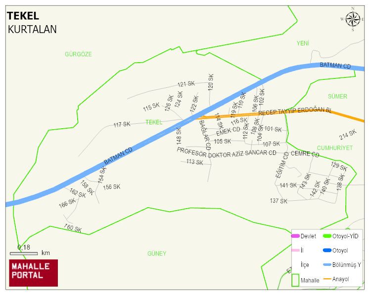
TEKEL Neighbourhood Digital Map | Mountains, Rivers and Elevation Details
TEKEL Neighbourhood – Population, Postal Code, Number of Workplaces
TEKEL neighborhood is located in KURTALAN district of SIIRT province. UAVT (National Address Database Code) Neighborhood Code: 70175. Postal Code: 56500. The population density is -per square kilometer- 3600 people. TEKEL 50 streets and avenues, 135 independent business licensed apartments, 1758 residential licensed apartments, 1182 households. 5540 people live in this settlement. 2790 male, 2750 female. 1318 people have never married, 2126 people are married, 27 people are divorced and 107 people have passed away. The number of people aged 60 and over is 323. The population rate of 60+ people is % 5 and the ratio of children under the age of 10 to the population is % 23 KURTALAN -in the district- 2. the most crowded neighbourhood.