TOP 10: NÜFUS
İzmir ilinde,
Tire ilçesinde, mahalleler içinde,
Aile içindeki genç oranı sıralamasında 5. Toki beşinci sırada konumlanan mahallelerden biridir.
| Adi | TOKI Province Affiliated | IZMIR District Affiliated | TIRE Postal code | 35900 Number of Streets | 11 Population Density km2-people | 260.27 Number of Apartments with business Licenses | 123 Number of Apartments with Residential Licenses | 1395 Number of Households / Families | 1037 Total Population | 2753 Male Population | 1341 Woman Population | 1412 Income Per Person - Spendable TL-Month | 10.206 |
|---|
TOKI Neighbourhood Map | Updated Neighbourhood Map
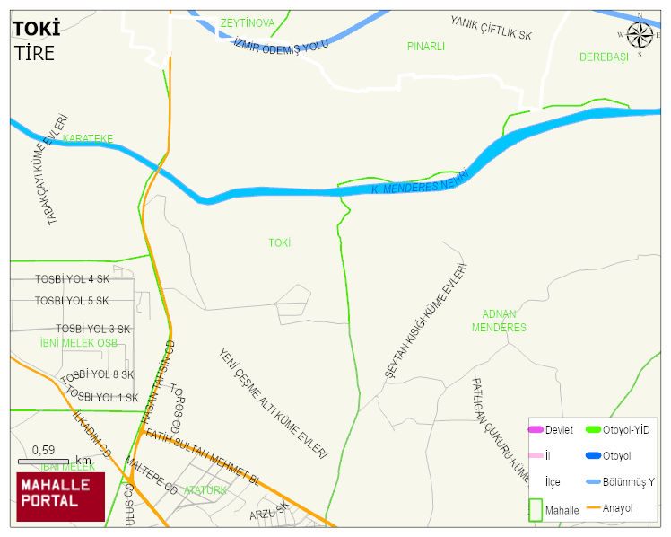
TOKI Neighbourhood Digital Map | Detailed Villages and Neighbourhoods
TOKI Neighbourhood – Population, Postal Code, Number of Workplaces
TOKI neighborhood is located in TIRE district of IZMIR province. UAVT (National Address Database Code) Neighborhood Code: 139639. Postal Code: 35900. The population density is -per square kilometer- 261 people. TOKI 11 streets and avenues, 105 independent business licensed apartments, 1394 residential licensed apartments, 1019 households. 2765 people live in this settlement. 1347 male, 1418 female. 460 people have never married, 1336 people are married, 268 people are divorced and 92 people have passed away. The number of people aged 60 and over is 381. The population rate of 60+ people is % 13 and the ratio of children under the age of 10 to the population is % 14 TIRE -in the district- 9. the most crowded neighbourhood.