TOP 10: NÜFUS
Diyarbakır ilinde,
Hazro ilçesinde, mahalleler içinde,
Ekonomik gücü en yüksek listesinde 4. Topalan dördüncü sırada konumlanan mahallelerden biridir.
Esnaf–işletme sayısı lider listesinde 2. Topalan şehir içi sıralamada 2. sıradadır.
M² arsa değerinin en çok olduğu listesinde 3. Topalan sıralamada üçüncü sırada yer almaktadır.
ATM yoğunluğu en yüksek listesinde 1. Topalan sıralamada birinci olarak kayda geçmiştir.
Sokak dokusu zengin bölgeler listesinde 5. Topalan istatistik listelerinde beşinci basamakta yer alır.
| Adi | TOPALAN Province Affiliated | DIYARBAKIR District Affiliated | HAZRO Postal code | 21560 Number of Streets | 12 Population Density km2-people | 1647.25 Number of Apartments with business Licenses | 62 Number of Apartments with Residential Licenses | 176 Number of Households / Families | 128 Total Population | 494 Male Population | 244 Woman Population | 250 Income Per Person - Spendable TL-Month | 6.884 |
|---|
TOPALAN Neighbourhood Map | Geography and Natural Features
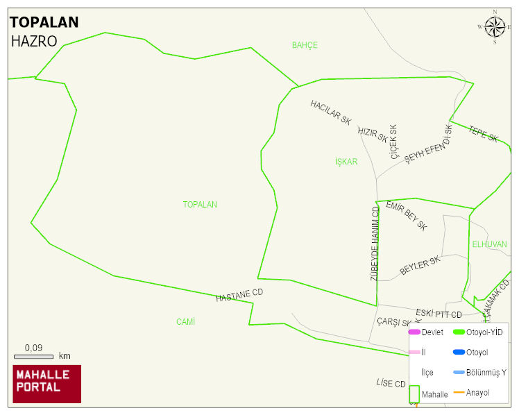
TOPALAN Neighbourhood Digital Map | Satellite View and Local Boundaries
TOPALAN Neighbourhood – Population, Postal Code, Number of Workplaces
TOPALAN neighborhood is located in HAZRO district of DIYARBAKIR province. UAVT (National Address Database Code) Neighborhood Code: 21114. Postal Code: 21560. The population density is -per square kilometer- 1861 people. TOPALAN 12 streets and avenues, 62 independent business licensed apartments, 171 residential licensed apartments, 133 households. 558 people live in this settlement. 276 male, 282 female. 60 and over is 32. The population rate of 60+ people is % 5 and the ratio of children under the age of 10 to the population is % 25