TOP 10: NÜFUS
Ankara ilinde,
Yenimahalle ilçesinde, mahalleler içinde,
Mesken sayısı sıralamasında 2. Uğur Mumcu ikinci sırada yer almaktadır.
Üst yaş grubunda lider listesinde 2. Uğur Mumcu ikinci sırada yer almaktadır.
Sokak ağına ilişkin sıralamada 5. Uğur Mumcu 5. sırada olmasıyla öne çıkar.
| Adi | UGUR MUMCU Province Affiliated | ANKARA District Affiliated | YENIMAHALLE Postal code | 06370 Number of Streets | 111 Population Density km2-people | 4997.23 Number of Apartments with business Licenses | 276 Number of Apartments with Residential Licenses | 13370 Number of Households / Families | 6963 Total Population | 18714 Male Population | 8896 Woman Population | 9818 Income Per Person - Spendable TL-Month | 30.866 |
|---|
UGUR MUMCU Neighbourhood Map | Updated Neighbourhood Map
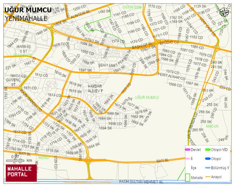
UGUR MUMCU Neighbourhood Digital Map | Mountains, Rivers and Elevation Details
UGUR MUMCU Neighbourhood – Population, Postal Code, Number of Workplaces
UGUR MUMCU neighborhood is located in YENIMAHALLE district of ANKARA province. UAVT (National Address Database Code) Neighborhood Code: 1889. Postal Code: 6370. The population density is -per square kilometer- 5064 people. UGUR MUMCU 112 streets and avenues, 285 independent business licensed apartments, 13370 residential licensed apartments, 6971 households. 18959 people live in this settlement. 9031 male, 9928 female. 4209 people have never married, 9538 people are married, 1362 people are divorced and 1187 people have passed away. The number of people aged 60 and over is 4924. The population rate of 60+ people is % 25 and the ratio of children under the age of 10 to the population is % 8 YENIMAHALLE -in the district- 9. the most crowded neighbourhood.