UGURLU Village Digital Map | All Neighbourhoods and Settlements
Düzce ilinde,
Akçakoca ilçesinde, köyler içinde,
Ev–hane sayısı en çok olan listesinde 2. Uğurlu ikinci konumda bulunan mahalledir.
Ev sayısı bakımından ilk sırada listesinde 3. Uğurlu sıralamada üçüncü sırada yer almaktadır.
Esnaf–işletme sayısı lider listesinde 3. Uğurlu şehir içi sıralamada 3. sıradadır.
Kıdemli nüfusun en çok olduğu listesinde 5. Uğurlu beşinci sırada bulunmasıyla üst sıralarda yer alır.
| Adi | UGURLU Province Affiliated | DÜZCE District Affiliated | AKÇAKOCA Postal code | 81652 Number of Streets | 1 Population Density km2-people | 95.12 Number of Apartments with business Licenses | 67 Number of Apartments with Residential Licenses | 505 Number of Households / Families | 209 Total Population | 526 Male Population | 260 Woman Population | 266 Income Per Person - Spendable TL-Month | 8.056 |
|---|
UGURLU Village Map | Satellite View and Local Boundaries
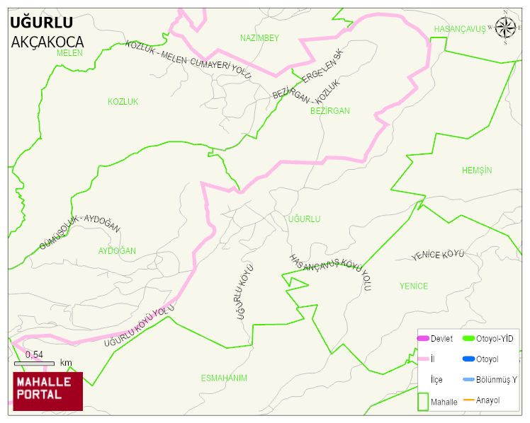
UGURLU Village Digital Map | All Neighbourhoods and Settlements
UGURLU Village – Population, Postal Code, Number of Workplaces
UGURLU village AKÇAKOCA district of DÜZCE province. UAVT (National Address Database Code) Village Code: 37494. Postal Code: 81652. UGURLU 1 streets and avenues, 67 independent business licensed apartments, 501 residential licensed apartments, 216 households. 567 people live in this settlement. 277 male, 290 female. 96 people have never married, 349 people are married, 15 people are divorced and 47 people have passed away. The number of people aged 60 and over is 222. The population rate of 60+ people is % 39 and the ratio of children under the age of 10 to the population is % 6
Leave a Comment