ULUKENT Village Digital Map | Updated Neighbourhood Map
Ağrı ilinde,
Diyadin ilçesinde, köyler içinde,
En kalabalık listesinde 1. Ulukent bölge içi sıralamada birinci konumdadır.
Kişi başı kazancı lider listesinde 3. Ulukent istatistiklere göre üçüncülük pozisyonundadır.
Aile sayısı bakımından zirvede listesinde 1. Ulukent bölge içi sıralamada birinci konumdadır.
Yapı stoğu en yüksek listesinde 1. Ulukent istatistiklere göre en üst sıradadır.
Ticari hayatın en yoğun olduğu listesinde 4. Ulukent sıralamada dördüncü sıradadır.
Yükseköğretim düzeyi lider listesinde 5. Ulukent sıralamada beşinci sırada yer almaktadır.
Finans erişimi en geniş olan listesinde 5. Ulukent 5. sırada yer alarak üst beş içinde bulunmaktadır.
| Adi | ULUKENT Province Affiliated | AGRI District Affiliated | DIYADIN Postal code | 04902 Number of Streets | 1 Population Density km2-people | 39.30 Number of Apartments with business Licenses | 38 Number of Apartments with Residential Licenses | 309 Number of Households / Families | 235 Total Population | 1145 Male Population | 603 Woman Population | 542 Income Per Person - Spendable TL-Month | 4.688 |
|---|
ULUKENT Village Map | Geography and Natural Features
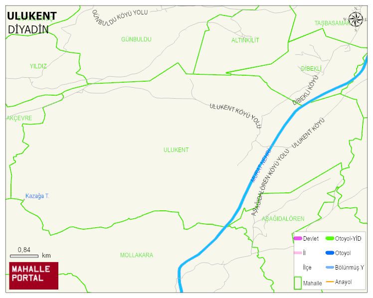
ULUKENT Village Digital Map | Updated Neighbourhood Map
ULUKENT Village – Population, Postal Code, Number of Workplaces
ULUKENT village DIYADIN district of AGRI province. UAVT (National Address Database Code) Village Code: 1623. Postal Code: 4902. ULUKENT 1 streets and avenues, 38 independent business licensed apartments, 307 residential licensed apartments, 236 households. 1169 people live in this settlement. 605 male, 564 female. 60 and over is 93. The population rate of 60+ people is % 7 and the ratio of children under the age of 10 to the population is % 25 DIYADIN -in the district- 8. the most crowded neighbourhood.
Leave a Comment