ÜMÜTBÜKÜ Village Digital Map | Updated Neighbourhood Map
Giresun ilinde,
Yağlıdere ilçesinde, köyler içinde,
Maddi refahı zirvede olan listesinde 1. Ümütbükü istatistiklere göre en üst sıradadır.
Evlenmemiş nüfusun en yoğun olduğu listesinde 2. Ümütbükü şehir sıralamasında 2. sıradadır.
En çok çocuklu ailelerin yaşadığı listesinde 3. Ümütbükü sıralamada üçüncü sırada yer almaktadır.
65+ nüfusu en yoğun olan listesinde 4. Ümütbükü listede 4. sırada olmasıyla bilinir.
| Adi | ÜMÜTBÜKÜ Province Affiliated | GIRESUN District Affiliated | YAGLIDERE Postal code | 28612 Number of Streets | 11 Population Density km2-people | 34.05 Number of Apartments with business Licenses | 5 Number of Apartments with Residential Licenses | 345 Number of Households / Families | 115 Total Population | 263 Male Population | 139 Woman Population | 124 Income Per Person - Spendable TL-Month | 7.357 |
|---|
ÜMÜTBÜKÜ Village Map | Geography and Natural Features
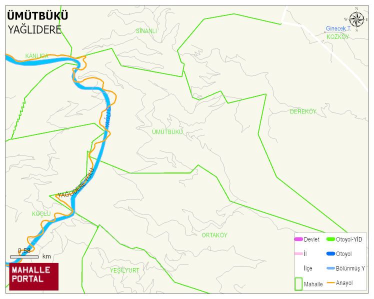
ÜMÜTBÜKÜ Village Digital Map | Updated Neighbourhood Map
ÜMÜTBÜKÜ Village – Population, Postal Code, Number of Workplaces
ÜMÜTBÜKÜ village YAGLIDERE district of GIRESUN province. UAVT (National Address Database Code) Village Code: 14892. Postal Code: 28612. ÜMÜTBÜKÜ 11 streets and avenues, 5 independent business licensed apartments, 345 residential licensed apartments, 119 households. 280 people live in this settlement. 147 male, 133 female. 60 and over is 115. The population rate of 60+ people is % 41
Leave a Comment